Approximate Location Map
Large Map »
Latitude: 51.2282 / 51°13'41"N
Longitude: 1.4037 / 1°24'13"E
OS Eastings: 637734
OS Northings: 153168
OS Grid: TR377531
Mapcode National: GBR X1R.V0X
Mapcode Global: VHMDG.8DXB
Plus Code: 9F336CH3+7F
Entry Name: Adelaide House
Listing Date: 1 June 1949
Grade: II
Source: Historic England
Source ID: 1069850
English Heritage Legacy ID: 177100
Also known as: 16 Griffin Street
ID on this website: 101069850
Location: Deal, Dover, Kent, CT14
County: Kent
District: Dover
Civil Parish: Deal
Built-Up Area: Deal
Traditional County: Kent
Lieutenancy Area (Ceremonial County): Kent
Tagged with: House
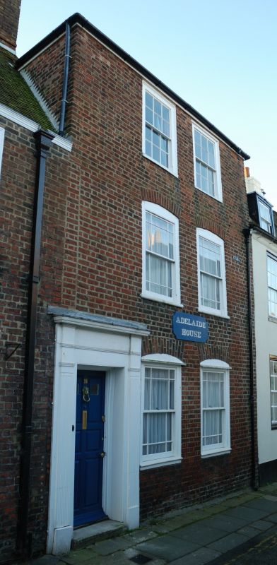
GRIFFIN STREET
1.
1035
(South Side )
No 16
TR 3753 SE 2/95 1.6.49. (Adelaide House)
II
GV
2.
Late C18. 3 storeys red brick. Wooden parapet. 2 sashes with glazing bars
intact on top floor only. Cambered heads to lower floor windows, Left side
doorcase with reeded pilasters; flat entablature and 6 fielded panelled door.
1 step.
Nos l3 to 17 (consec) form a group.
Listing NGR: TR3773453168
External links are from the relevant listing authority and, where applicable, Wikidata. Wikidata IDs may be related buildings as well as this specific building. If you want to add or update a link, you will need to do so by editing the Wikidata entry.


Other nearby listed buildings
