Approximate Location Map
Large Map »
Latitude: 51.2281 / 51°13'41"N
Longitude: 1.4031 / 1°24'11"E
OS Eastings: 637692
OS Northings: 153163
OS Grid: TR376531
Mapcode National: GBR X1R.TTF
Mapcode Global: VHMDG.8DLC
Plus Code: 9F336CH3+76
Entry Name: 18, Griffin Street
Listing Date: 1 June 1949
Grade: II
Source: Historic England
Source ID: 1253170
English Heritage Legacy ID: 177102
ID on this website: 101253170
Location: Deal, Dover, Kent, CT14
County: Kent
District: Dover
Civil Parish: Deal
Built-Up Area: Deal
Traditional County: Kent
Lieutenancy Area (Ceremonial County): Kent
Tagged with: Building
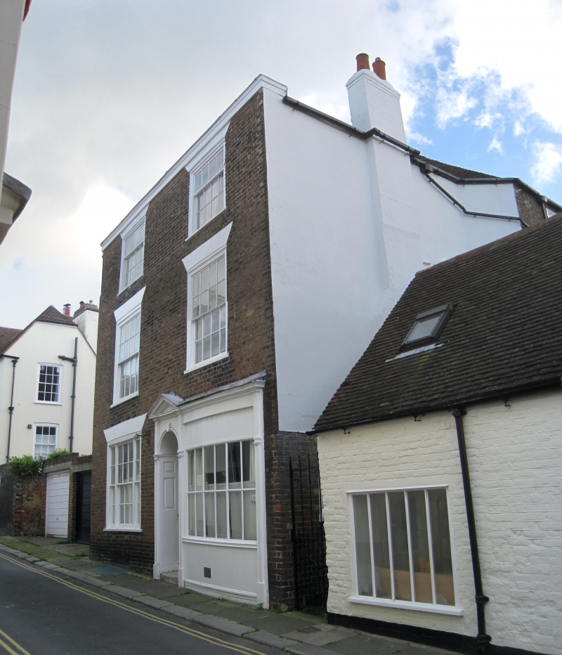
GRIFFIN STREET
1.
1035
(South Side)
No 18
TR 3753 SE 2/427 1.6.49.
II
2.
Early C19 house and shop. 3 storeys. 2 sashes. Partly original curved shop
front on right hand side, but modern glass. Doorcase with pilasters, pediment
and semi-circular fanlight. 6 panel moulded door.
Listing NGR: TR3769253163
External links are from the relevant listing authority and, where applicable, Wikidata. Wikidata IDs may be related buildings as well as this specific building. If you want to add or update a link, you will need to do so by editing the Wikidata entry.


Other nearby listed buildings
