Approximate Location Map
Large Map »
Latitude: 51.2261 / 51°13'33"N
Longitude: 1.4024 / 1°24'8"E
OS Eastings: 637653
OS Northings: 152932
OS Grid: TR376529
Mapcode National: GBR X1Y.1CB
Mapcode Global: VHMDG.8F7Y
Plus Code: 9F336CG2+CW
Entry Name: 121, High Street
Listing Date: 20 August 1973
Grade: II
Source: Historic England
Source ID: 1069810
English Heritage Legacy ID: 177109
ID on this website: 101069810
Location: Deal, Dover, Kent, CT14
County: Kent
District: Dover
Civil Parish: Deal
Built-Up Area: Deal
Traditional County: Kent
Lieutenancy Area (Ceremonial County): Kent
Tagged with: Building
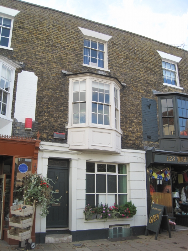
HIGH STREET
1.
1035
(West Side)
No 121
TR 3752 NE 1/286 20.8.73
II GV
2.
Early C19. 3 storeys yellow brick. Stone coping. 1 sash with glazing bars
intact, and 1st floor 3 light canted bay. The ground floor is rusticated and
has a doorcase with plain pilasters and cornice and rectangular fanlight. Included
for group value.
The Town Hall and Nos 115 to 127 (odd) form a group.
Listing NGR: TR3765352932
External links are from the relevant listing authority and, where applicable, Wikidata. Wikidata IDs may be related buildings as well as this specific building. If you want to add or update a link, you will need to do so by editing the Wikidata entry.


Other nearby listed buildings
