Approximate Location Map
Large Map »
Latitude: 51.2251 / 51°13'30"N
Longitude: 1.4033 / 1°24'11"E
OS Eastings: 637720
OS Northings: 152823
OS Grid: TR377528
Mapcode National: GBR X1Y.1MC
Mapcode Global: VHMDG.8GPQ
Plus Code: 9F336CG3+28
Entry Name: The Anchorage
Listing Date: 8 February 1974
Grade: II
Source: Historic England
Source ID: 1363447
English Heritage Legacy ID: 177146
ID on this website: 101363447
Location: Deal, Dover, Kent, CT14
County: Kent
District: Dover
Civil Parish: Deal
Built-Up Area: Deal
Traditional County: Kent
Lieutenancy Area (Ceremonial County): Kent
Tagged with: Architectural structure
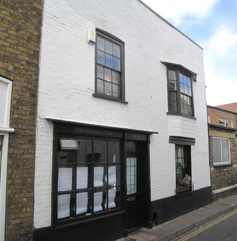
MIDDLE STREET
1.
1035
(West Side)
No 69
(The Anchorage)
TR 3752 NE 1/313
II
2.
Mid C19. 2 storeys painted brick. Parapet. 1 sash with cambered head and glazing
bars intact and 1 3-light canted bay on the 1st floor. The ground floor has
a left side C19 shop front incorporating a doorcase. Group value with No 67.
Listing NGR: TR3772052823
External links are from the relevant listing authority and, where applicable, Wikidata. Wikidata IDs may be related buildings as well as this specific building. If you want to add or update a link, you will need to do so by editing the Wikidata entry.


Other nearby listed buildings
