Approximate Location Map
Large Map »
Latitude: 51.2261 / 51°13'33"N
Longitude: 1.4032 / 1°24'11"E
OS Eastings: 637710
OS Northings: 152936
OS Grid: TR377529
Mapcode National: GBR X1Y.1KX
Mapcode Global: VHMDG.8FNY
Plus Code: 9F336CG3+C7
Entry Name: 85, Middle Street
Listing Date: 8 February 1974
Grade: II
Source: Historic England
Source ID: 1069786
English Heritage Legacy ID: 177152
ID on this website: 101069786
Location: Deal, Dover, Kent, CT14
County: Kent
District: Dover
Civil Parish: Deal
Built-Up Area: Deal
Traditional County: Kent
Lieutenancy Area (Ceremonial County): Kent
Tagged with: Building
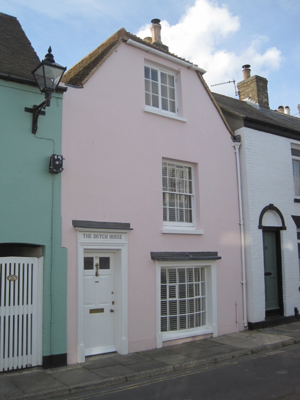
MIDDLE STREET
1.
1035
(West Side)
No 85
TR 5752 NE 1/316
II GV
2.
C18. 2 storeys and attics stuccoed. Half-hipped tiled roof. 1 modern casement
on 2nd floor, 1 sash with glazing bars intact and shutters on the 1st floor and
1 modern bow on ground floor. Left side modern pedimented doorcase with pilasters
and 6 fielded panelled door.
Nos 8l to 101 (odd) form a group.
Listing NGR: TR3771052936
External links are from the relevant listing authority and, where applicable, Wikidata. Wikidata IDs may be related buildings as well as this specific building. If you want to add or update a link, you will need to do so by editing the Wikidata entry.


Other nearby listed buildings
