Approximate Location Map
Large Map »
Latitude: 51.2288 / 51°13'43"N
Longitude: 1.4032 / 1°24'11"E
OS Eastings: 637700
OS Northings: 153240
OS Grid: TR377532
Mapcode National: GBR X1R.TWR
Mapcode Global: VHMDG.8CPV
Plus Code: 9F336CH3+G7
Entry Name: 179, Middle Street
Listing Date: 8 February 1974
Grade: II
Source: Historic England
Source ID: 1253825
English Heritage Legacy ID: 177182
ID on this website: 101253825
Location: Deal, Dover, Kent, CT14
County: Kent
District: Dover
Civil Parish: Deal
Built-Up Area: Deal
Traditional County: Kent
Lieutenancy Area (Ceremonial County): Kent
Tagged with: Building
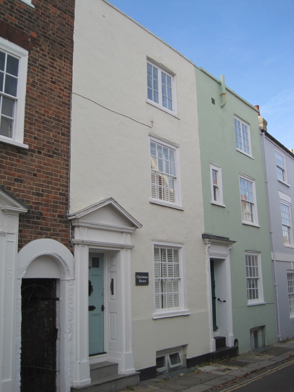
MIDDLE STREET
1.
1035
(West Side)
No 179
TR 3753 SE 2/114
II GV
2.
Early C19. 3 storeys and basement roughcast. Parapet. 1 sash with glazing
bars intact. Left side doorcase with pediment, panelled reveals and 6 panelled
door.
Nos 161 to 189 (odd) form a group.
Listing NGR: TR3770053240
External links are from the relevant listing authority and, where applicable, Wikidata. Wikidata IDs may be related buildings as well as this specific building. If you want to add or update a link, you will need to do so by editing the Wikidata entry.


Other nearby listed buildings
