Approximate Location Map
Large Map »
Latitude: 51.2272 / 51°13'38"N
Longitude: 1.4034 / 1°24'12"E
OS Eastings: 637716
OS Northings: 153064
OS Grid: TR377530
Mapcode National: GBR X1R.TXB
Mapcode Global: VHMDG.8FR1
Plus Code: 9F336CG3+V8
Entry Name: 112 and 114, Middle Street
Listing Date: 8 February 1974
Grade: II
Source: Historic England
Source ID: 1069766
English Heritage Legacy ID: 177203
ID on this website: 101069766
Location: Deal, Dover, Kent, CT14
County: Kent
District: Dover
Civil Parish: Deal
Built-Up Area: Deal
Traditional County: Kent
Lieutenancy Area (Ceremonial County): Kent
Tagged with: Building
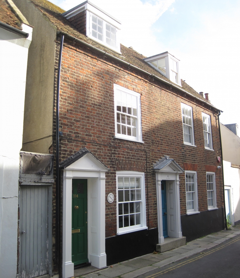
MIDDLE STREET
1.
1035
(East Side)
TR 3753 SE 2/61 Nos 112 and 114
II GV
2.
A pair of C18 cottages. 2 storeys and attics red brick. Half-hipped tiled roof
with 2 dormers. 3 windows. No 112 has a doorcase with pilasters and pediment
and 6 panel moulded door.
Nos 110 to 126 (even) form a group.
Listing NGR: TR3771653064
External links are from the relevant listing authority and, where applicable, Wikidata. Wikidata IDs may be related buildings as well as this specific building. If you want to add or update a link, you will need to do so by editing the Wikidata entry.


Other nearby listed buildings
