Approximate Location Map
Large Map »
Latitude: 51.2784 / 51°16'42"N
Longitude: 1.3336 / 1°20'1"E
OS Eastings: 632592
OS Northings: 158528
OS Grid: TR325585
Mapcode National: GBR X12.VBD
Mapcode Global: VHLGS.24DB
Plus Code: 9F3378HM+9F
Entry Name: Canterbury Gate House
Listing Date: 19 May 1950
Grade: II
Source: Historic England
Source ID: 1343702
English Heritage Legacy ID: 177281
ID on this website: 101343702
Location: Sandwich, Dover, Kent, CT13
County: Kent
District: Dover
Civil Parish: Sandwich
Built-Up Area: Sandwich
Traditional County: Kent
Lieutenancy Area (Ceremonial County): Kent
Tagged with: House
This list entry was subject to a Minor Amendment on 30 September 2021 to reformat text to current standards
TR 3258
5/195
ASH ROAD (South Side)
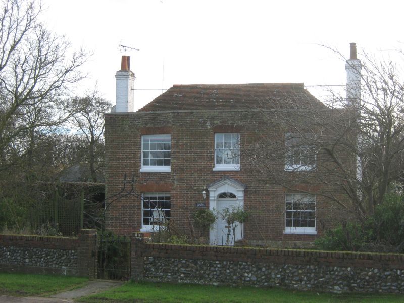
Canterbury Gate House
19.5.50.
II
L-shaped C18 house of two storeys, three windows. Front red brick, sides whitewashed. Parapet, tiled roof. Glazing bars missing. Doorway with fluted pilasters, pediment segmental fanlight and six-panel moulded door.
Listing NGR: TR3259358523
External links are from the relevant listing authority and, where applicable, Wikidata. Wikidata IDs may be related buildings as well as this specific building. If you want to add or update a link, you will need to do so by editing the Wikidata entry.


Other nearby listed buildings
