Approximate Location Map
Large Map »
Latitude: 51.276 / 51°16'33"N
Longitude: 1.3421 / 1°20'31"E
OS Eastings: 633193
OS Northings: 158286
OS Grid: TR331582
Mapcode National: GBR X12.XTF
Mapcode Global: VHLGS.66V5
Plus Code: 9F3378GR+9R
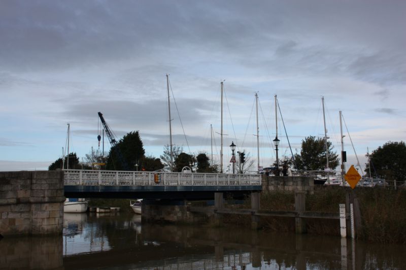
Entry Name: The Toll Bridge
Listing Date: 23 April 1976
Grade: II
Source: Historic England
Source ID: 1343735
English Heritage Legacy ID: 177438
Also known as: Sandwich Toll Bridge
ID on this website: 101343735
Location: Sandwich, Dover, Kent, CT13
County: Kent
District: Dover
Civil Parish: Sandwich
Built-Up Area: Sandwich
Traditional County: Kent
Lieutenancy Area (Ceremonial County): Kent
Tagged with: Bridge
1.
5275 HIGH STREET
(West Side)
The Toll Bridge
TR 3358 1/129A
II
2.
Built in 1773 of Portland stone having centre portion dated 1892 to open as
iron swing bridge, and upon the south and north ends stone arches. Central
portion probably Dutch type timber raised platform before C19 replacement.
Listing NGR: TR3319258284
External links are from the relevant listing authority and, where applicable, Wikidata. Wikidata IDs may be related buildings as well as this specific building. If you want to add or update a link, you will need to do so by editing the Wikidata entry.


Other nearby listed buildings
