Approximate Location Map
Large Map »
Latitude: 51.2764 / 51°16'35"N
Longitude: 1.3369 / 1°20'12"E
OS Eastings: 632830
OS Northings: 158319
OS Grid: TR328583
Mapcode National: GBR X12.W9T
Mapcode Global: VHLGS.454V
Plus Code: 9F3378GP+HQ
Entry Name: The Old Cottage
Listing Date: 19 May 1950
Grade: II
Source: Historic England
Source ID: 1343770
English Heritage Legacy ID: 177515
ID on this website: 101343770
Location: Sandwich, Dover, Kent, CT13
County: Kent
District: Dover
Civil Parish: Sandwich
Built-Up Area: Sandwich
Traditional County: Kent
Lieutenancy Area (Ceremonial County): Kent
Tagged with: Cottage
1.
5275 LOOP STREET
(North West Side)
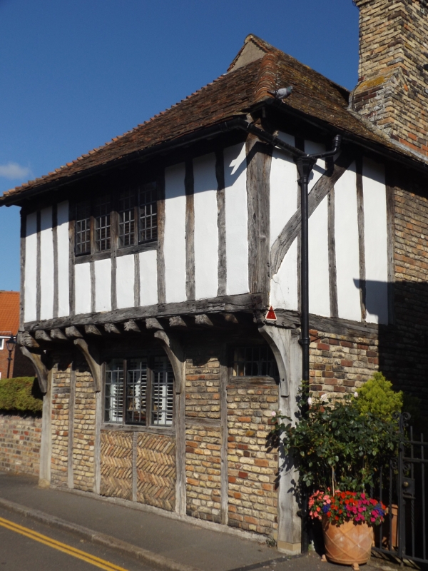
The Old Cottage
TR 3258 1/60 19.5.50.
II
2.
C15 timber framed house, the 1st floor overhanging on the protruding ends of
the floor joists and curved brackets. Ground floor has brick infilling, the
1st floor plaster. 2 storeys, one window, modern casement windows. On the
south side a room has been built out on the 1st floor on props and faced with
imitation timbering.
Listing NGR: TR3282858321
External links are from the relevant listing authority and, where applicable, Wikidata. Wikidata IDs may be related buildings as well as this specific building. If you want to add or update a link, you will need to do so by editing the Wikidata entry.


Other nearby listed buildings
