Approximate Location Map
Large Map »
Latitude: 51.2721 / 51°16'19"N
Longitude: 1.3419 / 1°20'30"E
OS Eastings: 633202
OS Northings: 157854
OS Grid: TR332578
Mapcode National: GBR X18.437
Mapcode Global: VHLGS.69S5
Plus Code: 9F3378CR+RQ
Entry Name: 32, Mill Wall Place
Listing Date: 23 April 1976
Grade: II
Source: Historic England
Source ID: 1343758
English Heritage Legacy ID: 177543
ID on this website: 101343758
Location: Sandwich, Dover, Kent, CT13
County: Kent
District: Dover
Civil Parish: Sandwich
Built-Up Area: Sandwich
Traditional County: Kent
Lieutenancy Area (Ceremonial County): Kent
Tagged with: Building
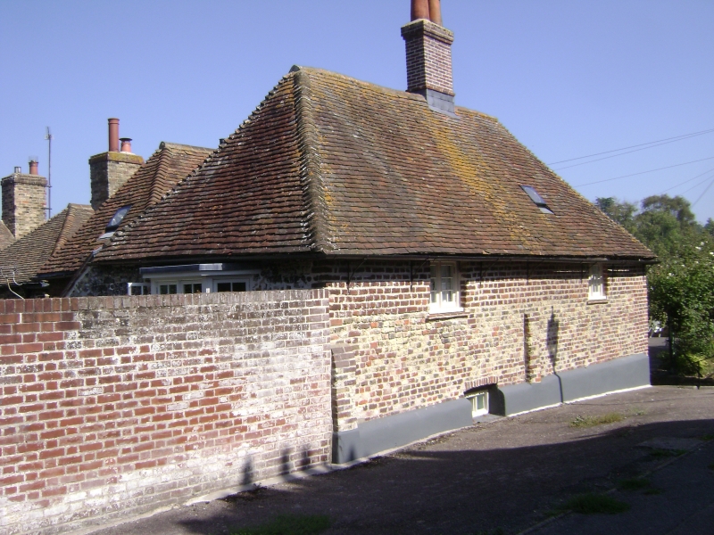
1.
5275 MILLWALL PLACE
(West Side)
No 32
TR 3357 NW 2/307
II GV
2.
Early C17 house in red brick of 2 storeys with tiled roof. Modern addition
in character. Original windows on 1st floor, casements intact. Also side
wall with the Rope Walk has original windows of casements complete.
Nos 10 to 32 (even) form a group.
Listing NGR: TR3319857854
External links are from the relevant listing authority and, where applicable, Wikidata. Wikidata IDs may be related buildings as well as this specific building. If you want to add or update a link, you will need to do so by editing the Wikidata entry.


Other nearby listed buildings
