Approximate Location Map
Large Map »
Latitude: 51.2733 / 51°16'23"N
Longitude: 1.3409 / 1°20'27"E
OS Eastings: 633123
OS Northings: 157982
OS Grid: TR331579
Mapcode National: GBR X18.3TV
Mapcode Global: VHLGS.6878
Plus Code: 9F3378FR+89
Entry Name: 49 and 51, New Street
Listing Date: 23 April 1976
Grade: II
Source: Historic England
Source ID: 1069582
English Heritage Legacy ID: 177570
ID on this website: 101069582
Location: Sandwich, Dover, Kent, CT13
County: Kent
District: Dover
Civil Parish: Sandwich
Built-Up Area: Sandwich
Traditional County: Kent
Lieutenancy Area (Ceremonial County): Kent
Tagged with: Building
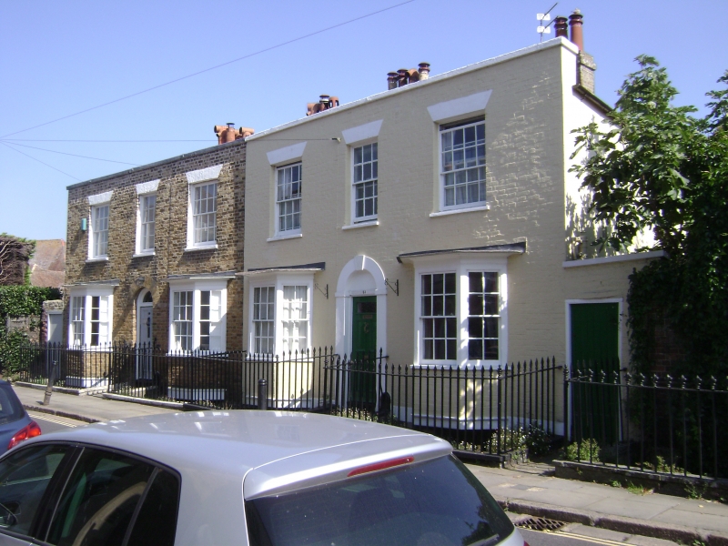
1.
5275 NEW STREET
(North East Side)
Nos 49 and 51
TR 3357 NW 2/82
II
2.
Pair of houses of about 1830-40 2 storeys. 3 windows each. Brown brick to
No 49 and painted brick to No 51. parapet and slate roofs. 2 bay windows
on ground floor of each house. Glazing bars intact. Round headed doorways
with semi-circular fanlights. In the space between the house and railings
is the artificial stream known as the Delf.
Listing NGR: TR3312257985
External links are from the relevant listing authority and, where applicable, Wikidata. Wikidata IDs may be related buildings as well as this specific building. If you want to add or update a link, you will need to do so by editing the Wikidata entry.


Other nearby listed buildings
