Approximate Location Map
Large Map »
Latitude: 51.2723 / 51°16'20"N
Longitude: 1.3412 / 1°20'28"E
OS Eastings: 633152
OS Northings: 157875
OS Grid: TR331578
Mapcode National: GBR X18.3XC
Mapcode Global: VHLGS.69D0
Plus Code: 9F3378CR+WF
Entry Name: The Limes
Listing Date: 23 April 1976
Grade: II
Source: Historic England
Source ID: 1069583
English Heritage Legacy ID: 177572
ID on this website: 101069583
Location: Sandwich, Dover, Kent, CT13
County: Kent
District: Dover
Civil Parish: Sandwich
Built-Up Area: Sandwich
Traditional County: Kent
Lieutenancy Area (Ceremonial County): Kent
Tagged with: Building
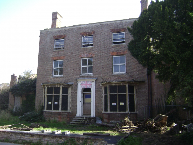
1.
5275 NEW STREET
(North East Side)
-----------------
No 57
(The Limes)
TR 3357 NW 2/84
II
2.
Early C19 house. 3 storeys, 3 windows, brown brick with red brick relieving
arches. Glazing bars missing to windows. 2 late C19 stone bay windows on ground
floor. Doorway approached with pilasters projecting cornice and semi-circular
fanlight. The Delf stream flows in front of the house.
Listing NGR: TR3315257871
External links are from the relevant listing authority and, where applicable, Wikidata. Wikidata IDs may be related buildings as well as this specific building. If you want to add or update a link, you will need to do so by editing the Wikidata entry.


Other nearby listed buildings
