Approximate Location Map
Large Map »
Latitude: 51.2729 / 51°16'22"N
Longitude: 1.3408 / 1°20'26"E
OS Eastings: 633118
OS Northings: 157936
OS Grid: TR331579
Mapcode National: GBR X18.3SW
Mapcode Global: VHLGS.685K
Plus Code: 9F3378FR+48
Entry Name: 68, New Street
Listing Date: 23 April 1976
Grade: II
Source: Historic England
Source ID: 1343787
English Heritage Legacy ID: 177587
ID on this website: 101343787
Location: Sandwich, Dover, Kent, CT13
County: Kent
District: Dover
Civil Parish: Sandwich
Built-Up Area: Sandwich
Traditional County: Kent
Lieutenancy Area (Ceremonial County): Kent
Tagged with: Building
1.
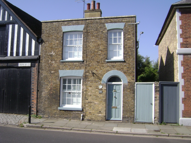
5275 NEW STREET
(South West Side)
No 68
TR 3357 NW 2/335
II GV
2.
Yellow brick building with parapet and slated roof. 3 windows, glazing bars
intact. Plastered flat arches and similar semi-circular arches over door.
door modern. House Circa 1830.
Nos 68 72 and 74 form a group.
Listing NGR: TR3311657936
External links are from the relevant listing authority and, where applicable, Wikidata. Wikidata IDs may be related buildings as well as this specific building. If you want to add or update a link, you will need to do so by editing the Wikidata entry.


Other nearby listed buildings
