Approximate Location Map
Large Map »
Latitude: 51.2727 / 51°16'21"N
Longitude: 1.3408 / 1°20'27"E
OS Eastings: 633122
OS Northings: 157922
OS Grid: TR331579
Mapcode National: GBR X18.3SY
Mapcode Global: VHLGS.686N
Plus Code: 9F3378FR+38
Entry Name: 70 and 72, New Street
Listing Date: 23 April 1976
Grade: II
Source: Historic England
Source ID: 1120882
English Heritage Legacy ID: 177588
ID on this website: 101120882
Location: Sandwich, Dover, Kent, CT13
County: Kent
District: Dover
Civil Parish: Sandwich
Built-Up Area: Sandwich
Traditional County: Kent
Lieutenancy Area (Ceremonial County): Kent
Tagged with: Building
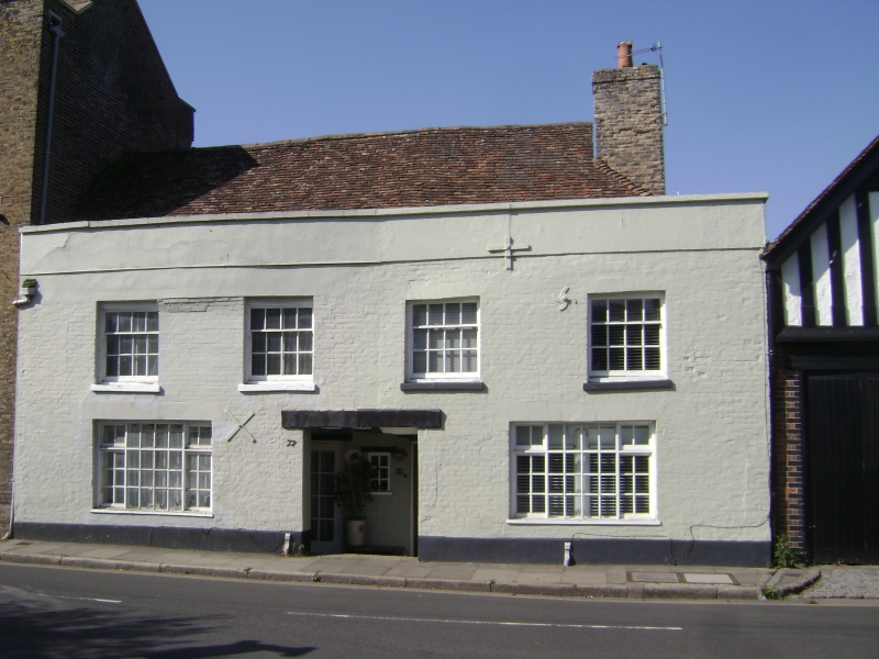
1.
5275 NEW STREET
(South West side)
Nos 70 and 72
TR 3357 NW 2/94
II GV
2.
Late C15 building refronted in the C18 of 2 storeys, 4 windows. Painted brick.
Parapet and plain tiled roof, glazing bars intact on 1st floor. Modern windows
below. Modern door entrance cut through wall giving access to 2 doors to flats.
Nos 68 72 and 74 form a group.
Listing NGR: TR3311957925
External links are from the relevant listing authority and, where applicable, Wikidata. Wikidata IDs may be related buildings as well as this specific building. If you want to add or update a link, you will need to do so by editing the Wikidata entry.


Other nearby listed buildings
