Approximate Location Map
Large Map »
Latitude: 51.1267 / 51°7'36"N
Longitude: 1.3267 / 1°19'36"E
OS Eastings: 632871
OS Northings: 141648
OS Grid: TR328416
Mapcode National: GBR X30.686
Mapcode Global: VHLHB.YY73
Plus Code: 9F3348GG+MM
Entry Name: 1-15, Atholl Terrace
Listing Date: 17 December 1973
Grade: II
Source: Historic England
Source ID: 1069520
English Heritage Legacy ID: 177721
ID on this website: 101069520
Location: Victoria Park Mews, Dover, Kent, CT16
County: Kent
District: Dover
Civil Parish: Dover
Built-Up Area: Dover
Traditional County: Kent
Lieutenancy Area (Ceremonial County): Kent
Tagged with: Building
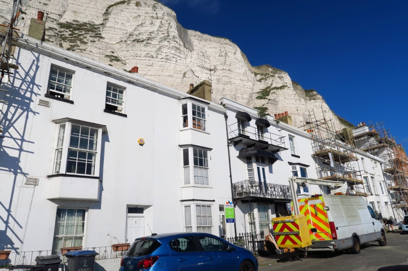
ATHOLL TERRACE
1.
1050 Nos 1 to 15 (consec)
TR 3241 1/72
II GV
2.
A miscellaneous early C19 terrace of 3 storeys stuccoed, but some are now
pebble dashed. Parapets. Some hipped tiled roofs. Mainly sashes. Some
3 light canted bays through 1 or 2 storeys. Simple doorcases, some with
later porches. No 4 has a Regency cast iron balcony.
Forms a group with Nos 36 to 39 (consec) East Cliff Terrace.
Listing NGR: TR3287141648
External links are from the relevant listing authority and, where applicable, Wikidata. Wikidata IDs may be related buildings as well as this specific building. If you want to add or update a link, you will need to do so by editing the Wikidata entry.


Other nearby listed buildings
