Approximate Location Map
Large Map »
Latitude: 51.1268 / 51°7'36"N
Longitude: 1.3174 / 1°19'2"E
OS Eastings: 632218
OS Northings: 141624
OS Grid: TR322416
Mapcode National: GBR X2Z.9VV
Mapcode Global: VHLHB.SY92
Plus Code: 9F3348G8+PW
Entry Name: 4 and 6, Castle Hill Road
Listing Date: 17 December 1973
Grade: II
Source: Historic England
Source ID: 1069523
English Heritage Legacy ID: 177726
ID on this website: 101069523
Location: Victoria Park Mews, Dover, Kent, CT16
County: Kent
District: Dover
Civil Parish: Dover
Built-Up Area: Dover
Traditional County: Kent
Lieutenancy Area (Ceremonial County): Kent
Tagged with: Building
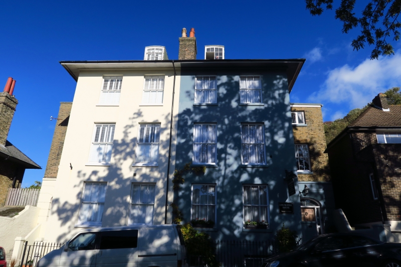
CASTLE HILL ROAD
1. (North Side)
1050
Nos 4 and 6
TR 3241 1/82
II GV
2.
A Mid C19 pair. 3 storeys and basement stuccoed. Slate roof with 2 dormers.
Each has a recessed side portion of 1 bay. 3 sashes each with glazing bars
intact. Simple 6 panelled doorcases. No 4 has a later glass roofed porch.
Nos 2,4 and 6 form a group.
Listing NGR: TR3221841624
External links are from the relevant listing authority and, where applicable, Wikidata. Wikidata IDs may be related buildings as well as this specific building. If you want to add or update a link, you will need to do so by editing the Wikidata entry.


Other nearby listed buildings
