Approximate Location Map
Large Map »
Latitude: 51.1261 / 51°7'33"N
Longitude: 1.3156 / 1°18'56"E
OS Eastings: 632098
OS Northings: 141539
OS Grid: TR320415
Mapcode National: GBR X2Z.9FY
Mapcode Global: VHLHB.RYCM
Plus Code: 9F3348G8+C6
Entry Name: 34 and 36, Castle Street
Listing Date: 17 December 1973
Grade: II
Source: Historic England
Source ID: 1343798
English Heritage Legacy ID: 177736
ID on this website: 101343798
Location: Victoria Park Mews, Dover, Kent, CT16
County: Kent
District: Dover
Civil Parish: Dover
Built-Up Area: Dover
Traditional County: Kent
Lieutenancy Area (Ceremonial County): Kent
Tagged with: Building
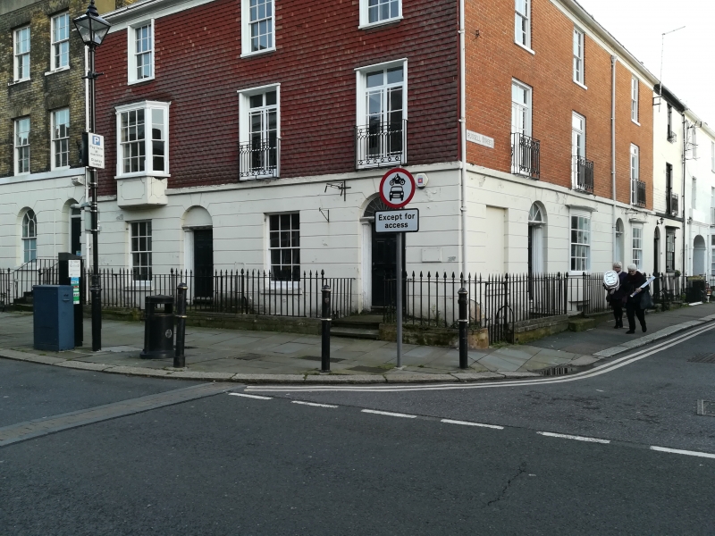
CASTLE STREET
1. (South East Side)
1050
Nos 34 and 36 34 and 36
TR 3241 1/88
II GV
2.
Mid C19. 3 storeys and basement. The upper 2 floors are hung with modern
tiles. Ground floor stuccoed. Hipped slate roof. 3 sashes with glazing
bars intact. 1 3-light canted bay and 2 sashes with balconettes on 1st floor.
2 round-headed doorcases with 1/4 Tuscan columns in antis. 6 panelled door.
Spear railings.
Nos 16 to 58 (even) form a group.
Listing NGR: TR3209841539
External links are from the relevant listing authority and, where applicable, Wikidata. Wikidata IDs may be related buildings as well as this specific building. If you want to add or update a link, you will need to do so by editing the Wikidata entry.


Other nearby listed buildings
