Approximate Location Map
Large Map »
Latitude: 51.1443 / 51°8'39"N
Longitude: 1.2772 / 1°16'38"E
OS Eastings: 629324
OS Northings: 143446
OS Grid: TR293434
Mapcode National: GBR W1D.5R0
Mapcode Global: VHLHB.3H2M
Plus Code: 9F3347VG+PV
Entry Name: Weeford
Listing Date: 30 June 1949
Grade: II
Source: Historic England
Source ID: 1069530
English Heritage Legacy ID: 177743
ID on this website: 101069530
Location: River, Dover, Kent, CT17
County: Kent
District: Dover
Civil Parish: River
Built-Up Area: Dover
Traditional County: Kent
Lieutenancy Area (Ceremonial County): Kent
Tagged with: Building
COMMON LANE
1. CRABBLE
1050
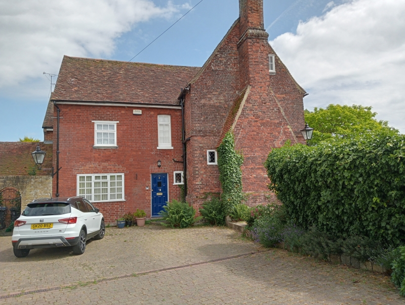
No 3 (Weeford)
TR 2943 5/59 30.6.49.
II
2.
Dated 1693. 2 storeys and attic red brick. Tiled roof with 2 dormers.
Brick cornice and stringcourse. 5 sashes with glazing bars intact. Doorcase
with pilasters and 6 panelled door. A brick chimney breast of earlier date
on the north side of the house is tile-hung. The rear elevation has a later
wing of 2 storeys red brick.
Listing NGR: TR2932443446
External links are from the relevant listing authority and, where applicable, Wikidata. Wikidata IDs may be related buildings as well as this specific building. If you want to add or update a link, you will need to do so by editing the Wikidata entry.


Other nearby listed buildings
