Approximate Location Map
Large Map »
Latitude: 51.1258 / 51°7'32"N
Longitude: 1.3085 / 1°18'30"E
OS Eastings: 631606
OS Northings: 141481
OS Grid: TR316414
Mapcode National: GBR X2Z.7NM
Mapcode Global: VHLHB.MYMW
Plus Code: 9F3348G5+8C
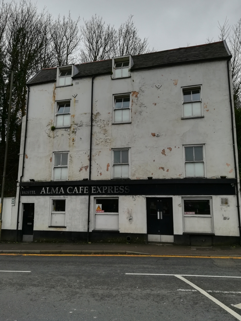
Entry Name: The Alma Public House
Listing Date: 17 December 1973
Grade: II
Source: Historic England
Source ID: 1343822
English Heritage Legacy ID: 177766
ID on this website: 101343822
Location: Dover, Kent, CT17
County: Kent
District: Dover
Civil Parish: Dover
Built-Up Area: Dover
Traditional County: Kent
Lieutenancy Area (Ceremonial County): Kent
Tagged with: Pub
TR 3141
2/103
FOLKESTONE ROAD (South Side)
No 37 (The Alma Public House)
II
Early C19. Three storeys and attics stuccoed. Tiled roof with two dormers. Three sashes with verticals only. Stringcourse. C19 pub front.
Listing NGR: TR3160641481
External links are from the relevant listing authority and, where applicable, Wikidata. Wikidata IDs may be related buildings as well as this specific building. If you want to add or update a link, you will need to do so by editing the Wikidata entry.


Other nearby listed buildings
