Approximate Location Map
Large Map »
Latitude: 51.1347 / 51°8'4"N
Longitude: 1.2998 / 1°17'59"E
OS Eastings: 630952
OS Northings: 142450
OS Grid: TR309424
Mapcode National: GBR W1F.ZBD
Mapcode Global: VHLHB.HQ1Z
Plus Code: 9F3347MX+VW
Entry Name: 110, London Road
Listing Date: 5 September 1969
Grade: II
Source: Historic England
Source ID: 1069504
English Heritage Legacy ID: 177782
ID on this website: 101069504
Location: St Radigund's, Dover, Kent, CT17
County: Kent
District: Dover
Civil Parish: Dover
Built-Up Area: Dover
Traditional County: Kent
Lieutenancy Area (Ceremonial County): Kent
Tagged with: Building
LONDON ROAD
1. (North East Side)
1050
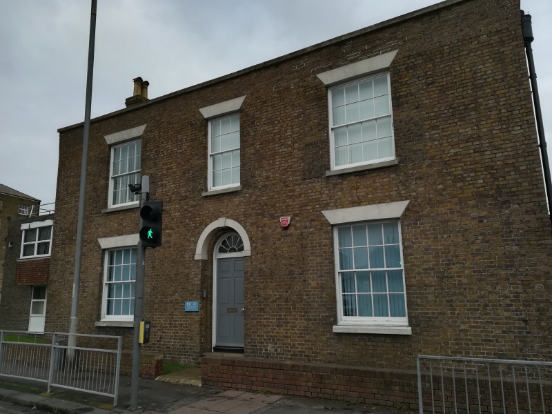
No 110
TR 3042 4/42 5.9.69.
II GV
2.
Early Cl9. 2 storeys brown brick. Parapet, 3 sashes With glazing bars
intact. Venetian shutters to windows. Round-headed doorcase with semi-circular
fanlight and 6 panelled moulded door.
The listed buildings from No 107 to No 116 form a group.
Listing NGR: TR3095242450
External links are from the relevant listing authority and, where applicable, Wikidata. Wikidata IDs may be related buildings as well as this specific building. If you want to add or update a link, you will need to do so by editing the Wikidata entry.


Other nearby listed buildings
