Approximate Location Map
Large Map »
Latitude: 51.1327 / 51°7'57"N
Longitude: 1.3022 / 1°18'7"E
OS Eastings: 631125
OS Northings: 142234
OS Grid: TR311422
Mapcode National: GBR X2S.S22
Mapcode Global: VHLHB.JS8J
Plus Code: 9F3348M2+3V
Entry Name: 279 and 280, London Road
Listing Date: 17 December 1973
Grade: II
Source: Historic England
Source ID: 1145851
English Heritage Legacy ID: 177792
ID on this website: 101145851
Location: St Radigund's, Dover, Kent, CT17
County: Kent
District: Dover
Civil Parish: Dover
Built-Up Area: Dover
Traditional County: Kent
Lieutenancy Area (Ceremonial County): Kent
Tagged with: Building
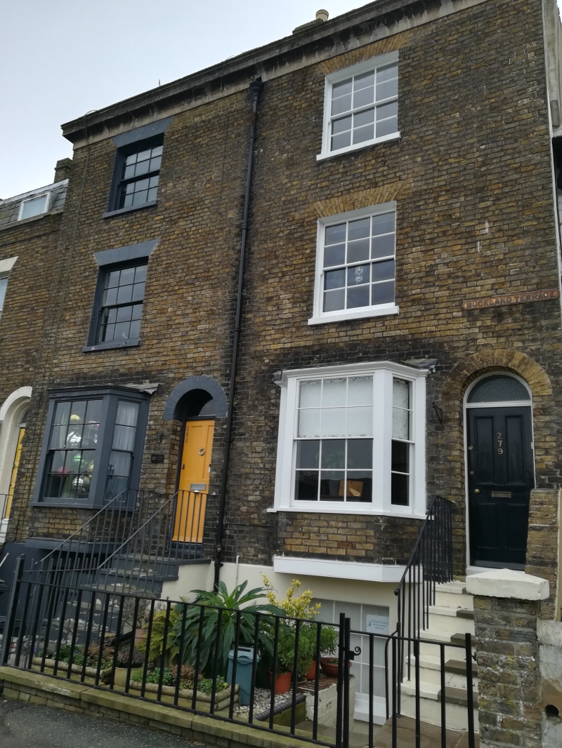
LONDON ROAD
1. (South West Side)
1050
Nos 279 and 280
TR 3142 3/129
II GV
2.
An early C19 pair. 3 storeys and basements brown brick. Parapet with moulded
cornice. 2 sashes without glazing bars. The ground floor has 3-light canted
bays and round-headed doorcases.
Nos 279 to 319 (consec) form a group.
Listing NGR: TR3112542234
External links are from the relevant listing authority and, where applicable, Wikidata. Wikidata IDs may be related buildings as well as this specific building. If you want to add or update a link, you will need to do so by editing the Wikidata entry.


Other nearby listed buildings
