Approximate Location Map
Large Map »
Latitude: 51.1273 / 51°7'38"N
Longitude: 1.3176 / 1°19'3"E
OS Eastings: 632229
OS Northings: 141679
OS Grid: TR322416
Mapcode National: GBR X2Z.9XW
Mapcode Global: VHLHB.SXDP
Plus Code: 9F3348G9+W2
Entry Name: 5 and 6, Laureston Place
Listing Date: 12 February 1987
Grade: II
Source: Historic England
Source ID: 1070331
English Heritage Legacy ID: 177841
ID on this website: 101070331
Location: Victoria Park Mews, Dover, Kent, CT16
County: Kent
District: Dover
Civil Parish: Dover
Built-Up Area: Dover
Traditional County: Kent
Lieutenancy Area (Ceremonial County): Kent
Tagged with: Building
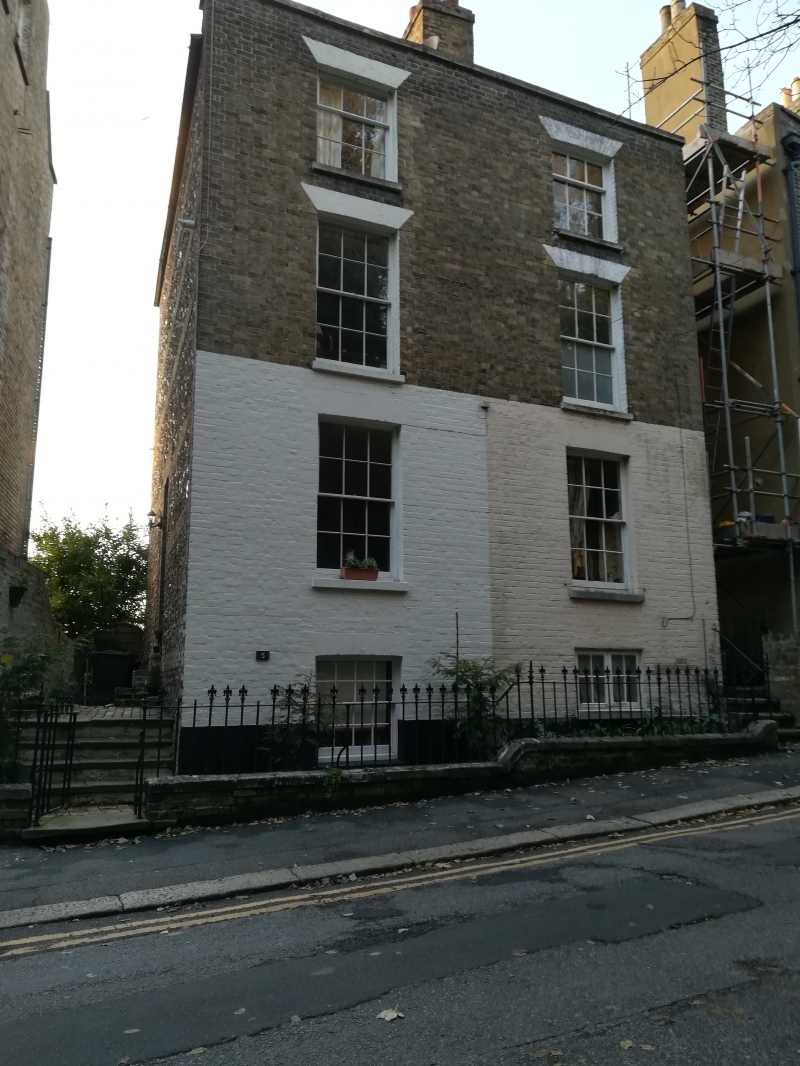
LAURESTON PLACE
1.
5275 Nos 5 and 6
TR 3241
1/115
II GV
Pair of houses. C1835. Front yellow brick, side elevations flint with yellow
brick lacing courses. Slate roof with yellow brick chimneystacks. 3 storeys
and semi basement. 1 window each. 2nd floor 9 pane sashes. Ground and 1st
floor 12 pane sashes. Parapet with stone coping. Spear railings. Doors in side
elevations. No 6 has a 6 flush panelled door and rectangular fanlight . Included
for group value only.
Listing NGR: TR3222941679
External links are from the relevant listing authority and, where applicable, Wikidata. Wikidata IDs may be related buildings as well as this specific building. If you want to add or update a link, you will need to do so by editing the Wikidata entry.


Other nearby listed buildings
