Approximate Location Map
Large Map »
Latitude: 51.2444 / 51°14'39"N
Longitude: 1.3144 / 1°18'51"E
OS Eastings: 631420
OS Northings: 154685
OS Grid: TR314546
Mapcode National: GBR X1F.WN5
Mapcode Global: VHLGR.QZQG
Plus Code: 9F3368V7+PQ
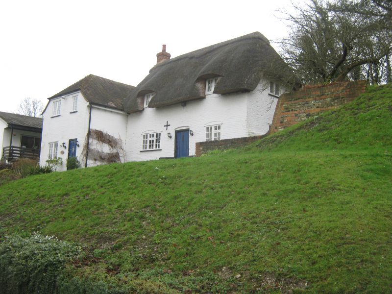
Entry Name: Bank Cottage
Listing Date: 27 February 1979
Grade: II
Source: Historic England
Source ID: 1363286
English Heritage Legacy ID: 178141
ID on this website: 101363286
Location: Eastry, Dover, Kent, CT13
County: Kent
District: Dover
Civil Parish: Eastry
Traditional County: Kent
Lieutenancy Area (Ceremonial County): Kent
Tagged with: Cottage Thatched cottage
EASTRY BROOK STREET
TR 3154
(south side)
13/110 Bank Cottage
27:2:79
GV II
House. C18 extended late C20. Painted brick and thatched roof extended with
painted brick and plain tiled roof. One storey and attic on flint plinth
with half-hipped roof, 2 flush dormers and stack to left. Two segmental headed
wooden casements (the opening to left altered). Central rib and stud door.
Projecting half-hipped late C20 wing to left.
Listing NGR: TR3142054685
External links are from the relevant listing authority and, where applicable, Wikidata. Wikidata IDs may be related buildings as well as this specific building. If you want to add or update a link, you will need to do so by editing the Wikidata entry.


Other nearby listed buildings
