Approximate Location Map
Large Map »
Latitude: 51.2449 / 51°14'41"N
Longitude: 1.3078 / 1°18'27"E
OS Eastings: 630956
OS Northings: 154722
OS Grid: TR309547
Mapcode National: GBR X1F.TQK
Mapcode Global: VHLGR.MZ71
Plus Code: 9F3368V5+X4
Entry Name: Horse Trough About 35 Metres North of the Riding Habit
Listing Date: 26 November 1987
Grade: II
Source: Historic England
Source ID: 1363289
English Heritage Legacy ID: 178156
ID on this website: 101363289
Location: Eastry, Dover, Kent, CT13
County: Kent
District: Dover
Civil Parish: Eastry
Built-Up Area: Eastry
Traditional County: Kent
Lieutenancy Area (Ceremonial County): Kent
Tagged with: Manger
EASTRY THE CROSS
TR 3054
(east side)
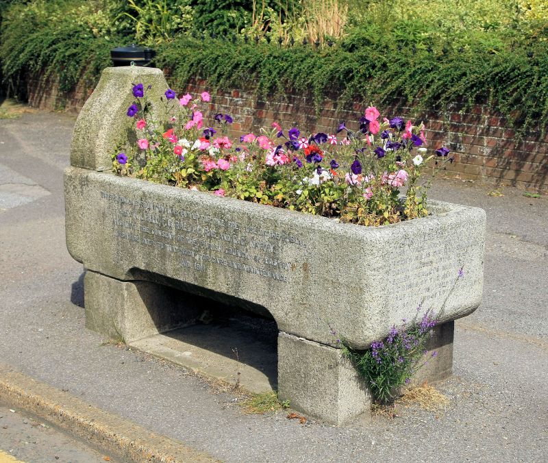
12/125 Horse trough
about 35 metres
north of The Riding
Habit
GV II
Water trough. Dated 1911, donated by K.Lyall, F C Rae, A C Rae and C G
Harty. Concrete or reconstituted stone. Plain trough on 2 blocks, with
ogee shaped head with drinking bowl. The fountain equipment has gone but the
salutary poem for the drinkers remains. Included for group value.
Listing NGR: TR3095654722
External links are from the relevant listing authority and, where applicable, Wikidata. Wikidata IDs may be related buildings as well as this specific building. If you want to add or update a link, you will need to do so by editing the Wikidata entry.


Other nearby listed buildings
