Approximate Location Map
Large Map »
Latitude: 51.2436 / 51°14'36"N
Longitude: 1.2995 / 1°17'58"E
OS Eastings: 630385
OS Northings: 154551
OS Grid: TR303545
Mapcode National: GBR W02.Z8V
Mapcode Global: VHLGY.G0VH
Plus Code: 9F3367VX+CQ
Entry Name: Eastry Mill
Listing Date: 13 October 1952
Grade: II
Source: Historic England
Source ID: 1070187
English Heritage Legacy ID: 178188
ID on this website: 101070187
Location: Gore, Dover, Kent, CT13
County: Kent
District: Dover
Civil Parish: Eastry
Built-Up Area: Eastry
Traditional County: Kent
Lieutenancy Area (Ceremonial County): Kent
Tagged with: Smock mill
TR 3054
12/157
13.10.52
EASTRY
MILL LANE
(south side)
Eastry Mill
GV
II
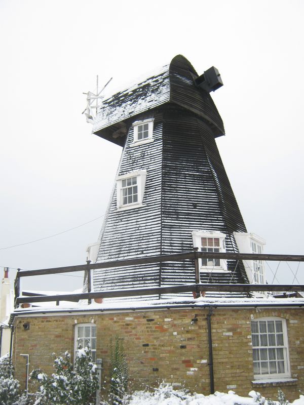
Windmill. Dated 1770. Timber framed and weather boarded. Smock mill, polygonal
plan with gambrel roof . Sails and winding gear missing. Ground floor building
of red brick with glazing bar sashes being reconstructed at time of survey.
Wall plaque dated 1985 proffers the date for original build of 1770.
Listing NGR: TR3038554551
External links are from the relevant listing authority and, where applicable, Wikidata. Wikidata IDs may be related buildings as well as this specific building. If you want to add or update a link, you will need to do so by editing the Wikidata entry.


Other nearby listed buildings
