Approximate Location Map
Large Map »
Latitude: 51.2637 / 51°15'49"N
Longitude: 1.2665 / 1°15'59"E
OS Eastings: 627984
OS Northings: 156683
OS Grid: TR279566
Mapcode National: GBR VZV.P0Q
Mapcode Global: VHLGQ.WHXM
Plus Code: 9F337778+FJ
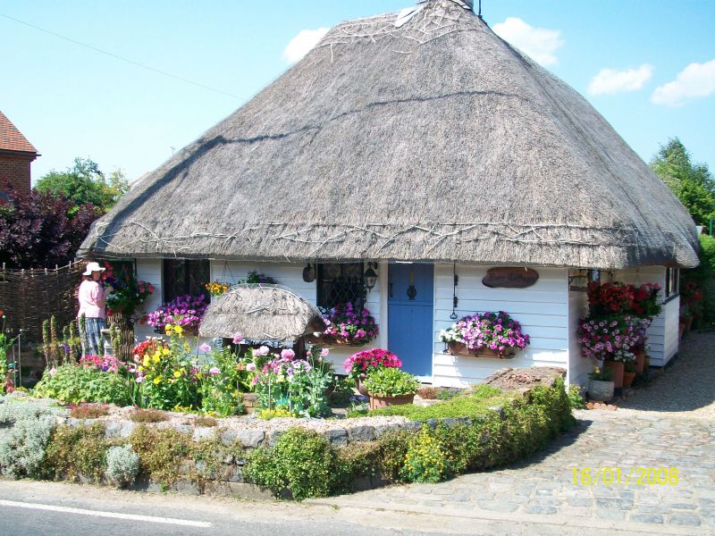
Entry Name: Rose Cottage
Listing Date: 26 November 1987
Grade: II
Source: Historic England
Source ID: 1070131
English Heritage Legacy ID: 178257
ID on this website: 101070131
Location: Barnsole, Dover, Kent, CT3
County: Kent
District: Dover
Civil Parish: Staple
Traditional County: Kent
Lieutenancy Area (Ceremonial County): Kent
Tagged with: Cottage Thatched cottage
TR 25 NE STAPLE FLEMING ROAD
(North Side)
5/226 Rose Cottage
II
House. C17. Timber framed and weather boarded with thatched roof. One
storey with hipped roof and stack to end left. One half-door and 2 wooden
casements on end left elevation, and 2 wooden casements and bay window on
right return.
Listing NGR: TR2798456683
External links are from the relevant listing authority and, where applicable, Wikidata. Wikidata IDs may be related buildings as well as this specific building. If you want to add or update a link, you will need to do so by editing the Wikidata entry.


Other nearby listed buildings
