Approximate Location Map
Large Map »
Latitude: 51.3241 / 51°19'26"N
Longitude: 1.2559 / 1°15'21"E
OS Eastings: 626948
OS Northings: 163362
OS Grid: TR269633
Mapcode National: GBR VZ2.SFR
Mapcode Global: VHLGB.QZBC
Plus Code: 9F3387F4+J9
Entry Name: Dog and Duck Cotatge
Listing Date: 26 November 1987
Grade: II
Source: Historic England
Source ID: 1070146
English Heritage Legacy ID: 178291
ID on this website: 101070146
Location: Plucks Gutter, Dover, Kent, CT3
County: Kent
District: Dover
Civil Parish: Stourmouth
Traditional County: Kent
Lieutenancy Area (Ceremonial County): Kent
Tagged with: Building
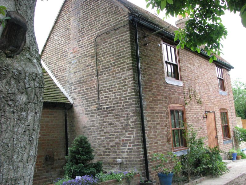
TR 26 SE STOURMOUTH PLUCK'S GUTTER
2/259 Dog and Duck
Cottage
II
House. C18. Red brick and plain tiled roof. Two storeys on plinth with
stacks to end left and to end right. Regular fenestration of 2 glazing bar
sashes on each floor, with segmental heads on ground floor. Central
boarded door. Single storey extension to left. Associated with the sluices
and gates of a cut in the River Stour.
Listing NGR: TR2694863362
External links are from the relevant listing authority and, where applicable, Wikidata. Wikidata IDs may be related buildings as well as this specific building. If you want to add or update a link, you will need to do so by editing the Wikidata entry.


Other nearby listed buildings
