Approximate Location Map
Large Map »
Latitude: 51.1855 / 51°11'7"N
Longitude: 1.4015 / 1°24'5"E
OS Eastings: 637800
OS Northings: 148424
OS Grid: TR378484
Mapcode National: GBR X2B.M4J
Mapcode Global: VHMDN.7GRJ
Plus Code: 9F335CP2+6H
Entry Name: Deal House
Listing Date: 22 August 1966
Grade: II
Source: Historic England
Source ID: 1070064
English Heritage Legacy ID: 178488
ID on this website: 101070064
Location: Kingsdown, Dover, Kent, CT14
County: Kent
District: Dover
Civil Parish: Ringwould with Kingsdown
Built-Up Area: Kingsdown
Traditional County: Kent
Lieutenancy Area (Ceremonial County): Kent
Tagged with: House
TR 34 NE RINGWOULD UPPER STREET
Kingsdown
3/49 Deal House
22.8.66 II
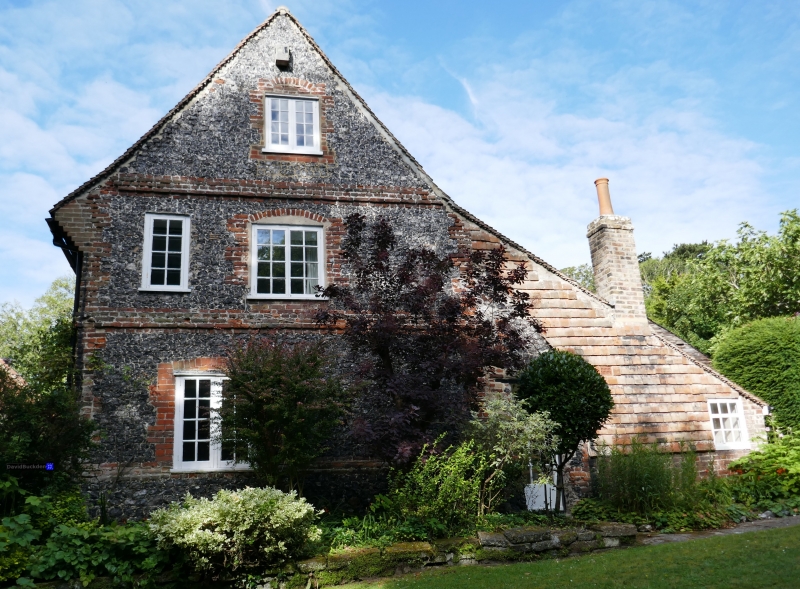
House. Early C18. Flint with red brick dressings and plain tiled roof.
Two storeys on plinth with quoins, pilaster strips to plat band and
corbelled eaves. Stack to centre left. Irregular fenestration of 6
wooden casements on each floor. Entry by glazed door in left return.
Interior: large scantling ceiling joists; some original fittings,
including doors with cockspur hinges.
Listing NGR: TR3754748215
External links are from the relevant listing authority and, where applicable, Wikidata. Wikidata IDs may be related buildings as well as this specific building. If you want to add or update a link, you will need to do so by editing the Wikidata entry.


Other nearby listed buildings
