Approximate Location Map
Large Map »
Latitude: 51.1974 / 51°11'50"N
Longitude: 0.2752 / 0°16'30"E
OS Eastings: 559061
OS Northings: 146701
OS Grid: TQ590467
Mapcode National: GBR MP0.Y32
Mapcode Global: VHHQ6.Q5BF
Plus Code: 9F3257WG+X3
Entry Name: 156, High Street
Listing Date: 20 January 1972
Grade: II
Source: Historic England
Source ID: 1363402
English Heritage Legacy ID: 178701
ID on this website: 101363402
Location: The Park, Tonbridge and Malling, Kent, TN9
County: Kent
District: Tonbridge and Malling
Electoral Ward/Division: Castle
Parish: Non Civil Parish
Built-Up Area: Tonbridge
Traditional County: Kent
Lieutenancy Area (Ceremonial County): Kent
Church of England Parish: Tonbridge St Peter and St Paul
Church of England Diocese: Rochester
Tagged with: Building
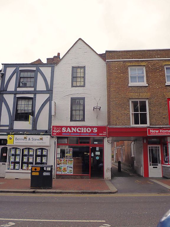
1. HIGH STREET
1732 (West Side)
No 156
TQ 5946 NW 3/27
II
2.
Building With a narrow frontage. Probably Cl7. 3 storeys, 1 window.
Painted brick. Tiled roof with gable. Stringcourse. above ground floor.
Sash windows. Glazing bars intact above ground floor. Modern shop front.
Listing NGR: TQ5905446702
External links are from the relevant listing authority and, where applicable, Wikidata. Wikidata IDs may be related buildings as well as this specific building. If you want to add or update a link, you will need to do so by editing the Wikidata entry.


Other nearby listed buildings
