Approximate Location Map
Large Map »
Latitude: 51.2239 / 51°13'26"N
Longitude: 0.3775 / 0°22'39"E
OS Eastings: 566117
OS Northings: 149877
OS Grid: TQ661498
Mapcode National: GBR NQ9.68T
Mapcode Global: VHJMJ.HHGL
Plus Code: 9F3269FH+H2
Entry Name: Bush Farmhouse
Listing Date: 19 April 1985
Grade: II
Source: Historic England
Source ID: 1070727
English Heritage Legacy ID: 178780
ID on this website: 101070727
Location: Peckham Bush, Tonbridge and Malling, Kent, TN12
County: Kent
District: Tonbridge and Malling
Civil Parish: East Peckham
Traditional County: Kent
Lieutenancy Area (Ceremonial County): Kent
Church of England Parish: East Peckham
Church of England Diocese: Rochester
Tagged with: Farmhouse
TQ 64 NE EAST PECKHAM BULLEN LANE
(west side)
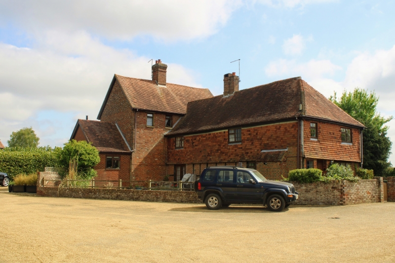
3/3 Bush Farmhouse
-
- II
Farmhouse. C18 Red brick ground floor, tile-hung 1st floor. Hipped plain tiled
roof with centre stack. 2 storeys, 3-window front. Mixture of C19 and C20
casement windows. Entrance off-centre to right. C19 gabled porch with barge-boards.
Listing NGR: TQ6601849329
External links are from the relevant listing authority and, where applicable, Wikidata. Wikidata IDs may be related buildings as well as this specific building. If you want to add or update a link, you will need to do so by editing the Wikidata entry.


Other nearby listed buildings
