Approximate Location Map
Large Map »
Latitude: 51.2236 / 51°13'24"N
Longitude: 0.3953 / 0°23'43"E
OS Eastings: 567361
OS Northings: 149881
OS Grid: TQ673498
Mapcode National: GBR NQ9.BR6
Mapcode Global: VHJMJ.SHVV
Plus Code: 9F3269FW+C4
Entry Name: Barn to South of Boroughs Oak Farmhouse
Listing Date: 19 April 1985
Grade: II
Source: Historic England
Source ID: 1070732
English Heritage Legacy ID: 178801
ID on this website: 101070732
Location: Hale Street, Tonbridge and Malling, Kent, TN12
County: Kent
District: Tonbridge and Malling
Civil Parish: East Peckham
Traditional County: Kent
Lieutenancy Area (Ceremonial County): Kent
Church of England Parish: East Peckham
Church of England Diocese: Rochester
Tagged with: Barn
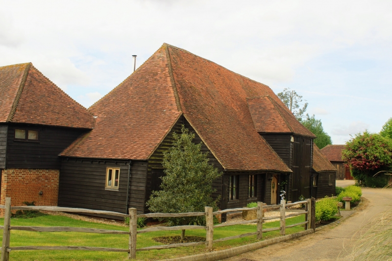
TQ 64 NE EAST PECKHAM HALE STREET (west side)
3/61 Barn to south of
Borough's Oak Farmhouse
-
GV II
Barn C18. Weather-boarded with tiled roof. Catslide to north. 5 bays. Some
jowled uprights. Wagon entrances on both sides. Included for group value
only.
Listing NGR: TQ6730448792
External links are from the relevant listing authority and, where applicable, Wikidata. Wikidata IDs may be related buildings as well as this specific building. If you want to add or update a link, you will need to do so by editing the Wikidata entry.


Other nearby listed buildings
