Approximate Location Map
Large Map »
Latitude: 51.2478 / 51°14'51"N
Longitude: 0.3706 / 0°22'14"E
OS Eastings: 565546
OS Northings: 152514
OS Grid: TQ655525
Mapcode National: GBR NPW.QJ2
Mapcode Global: VHJMB.CWSV
Plus Code: 9F3269XC+46
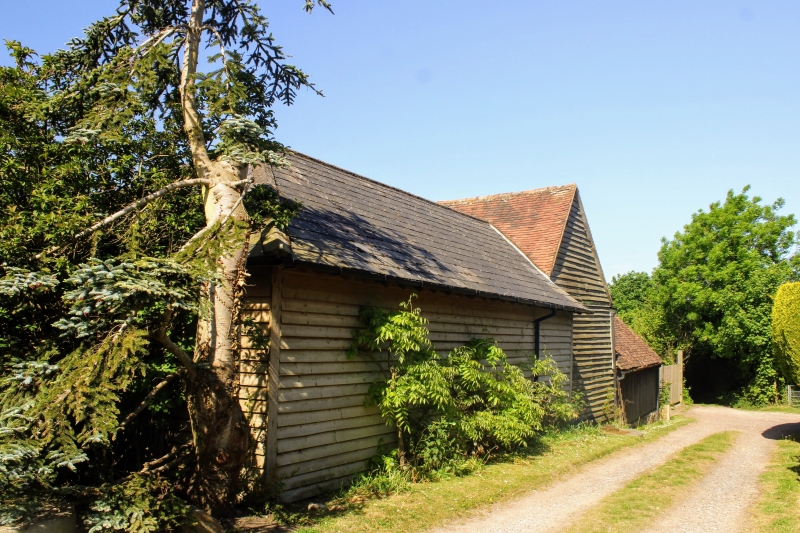
Entry Name: Barn 15 Yards North West of Forge Gate Farmhouse
Listing Date: 19 April 1985
Grade: II
Source: Historic England
Source ID: 1070735
English Heritage Legacy ID: 178810
ID on this website: 101070735
Location: West Peckham, Tonbridge and Malling, Kent, ME18
County: Kent
District: Tonbridge and Malling
Civil Parish: East Peckham
Traditional County: Kent
Lieutenancy Area (Ceremonial County): Kent
Church of England Parish: East Peckham
Church of England Diocese: Rochester
Tagged with: Barn
TQ 65 SE EAST PECKHAM MAIDSTONE ROAD (north
side)
2/44 Barn 15 yards north
west of Forge Gate
- Farmhouse
GV II
Barn. C18 Weather-boarded with plain tiled roof. East wagon entrance, cat-
slide to west. 5 bays.
Listing NGR: TQ6559352510
External links are from the relevant listing authority and, where applicable, Wikidata. Wikidata IDs may be related buildings as well as this specific building. If you want to add or update a link, you will need to do so by editing the Wikidata entry.


Other nearby listed buildings
