Approximate Location Map
Large Map »
Latitude: 51.2135 / 51°12'48"N
Longitude: 0.3848 / 0°23'5"E
OS Eastings: 566660
OS Northings: 148733
OS Grid: TQ666487
Mapcode National: GBR NQ9.VGN
Mapcode Global: VHJMJ.MR8M
Plus Code: 9F32697M+9W
Entry Name: Coults House
Listing Date: 19 April 1985
Grade: II
Source: Historic England
Source ID: 1185413
English Heritage Legacy ID: 178826
ID on this website: 101185413
Location: The Pound, Tonbridge and Malling, Kent, TN12
County: Kent
District: Tonbridge and Malling
Civil Parish: East Peckham
Built-Up Area: East Peckham
Traditional County: Kent
Lieutenancy Area (Ceremonial County): Kent
Church of England Parish: East Peckham
Church of England Diocese: Rochester
Tagged with: House
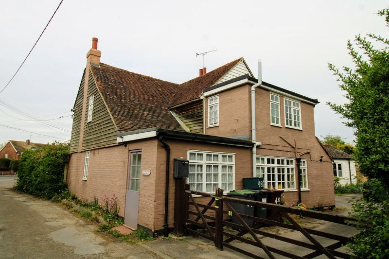
TQ 64 NE EAST PECKHAM POUND ROAD (east side)
3/52 Coults House
-
GV II
Cottage. Early C19. Painted brick ground floor, weather-boarded lst floor.
Plain tiled roof with end stacks. 2 storeys, 2 windows, casements. Doorway
in later east addition. Included for group value.
Listing NGR: TQ6661248724
External links are from the relevant listing authority and, where applicable, Wikidata. Wikidata IDs may be related buildings as well as this specific building. If you want to add or update a link, you will need to do so by editing the Wikidata entry.


Other nearby listed buildings
