Approximate Location Map
Large Map »
Latitude: 51.262 / 51°15'43"N
Longitude: 0.3655 / 0°21'55"E
OS Eastings: 565140
OS Northings: 154089
OS Grid: TQ651540
Mapcode National: GBR NPP.WRF
Mapcode Global: VHJMB.9J2W
Plus Code: 9F327968+R6
Entry Name: Barn 20 Yards to the West of Barons Place Farm
Listing Date: 19 April 1985
Grade: II
Source: Historic England
Source ID: 1363029
English Heritage Legacy ID: 178890
ID on this website: 101363029
Location: New Pound, Tonbridge and Malling, Kent, ME18
County: Kent
District: Tonbridge and Malling
Civil Parish: Mereworth
Traditional County: Kent
Lieutenancy Area (Ceremonial County): Kent
Church of England Parish: Mereworth St Lawrence
Church of England Diocese: Rochester
Tagged with: Barn Thatched barn
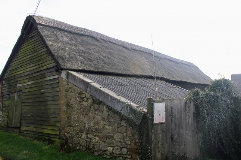
TQ 65 SE MEREWORTH WILLOW WENTS
(south side)
2/18 Barn 20 yards to the
west of Barons Place
- Farm
- II
Early Cl9 barn. Weather-boarded on brick plinth. Thatched roof. West wagon
entrance, east entrance covered by later catslide. 6 bays.
Listing NGR: TQ6555454193
External links are from the relevant listing authority and, where applicable, Wikidata. Wikidata IDs may be related buildings as well as this specific building. If you want to add or update a link, you will need to do so by editing the Wikidata entry.


Other nearby listed buildings
