Approximate Location Map
Large Map »
Latitude: 51.2551 / 51°15'18"N
Longitude: 0.4229 / 0°25'22"E
OS Eastings: 569170
OS Northings: 153448
OS Grid: TQ691534
Mapcode National: GBR NPY.CQ7
Mapcode Global: VHJMC.8QX6
Plus Code: 9F327C4F+25
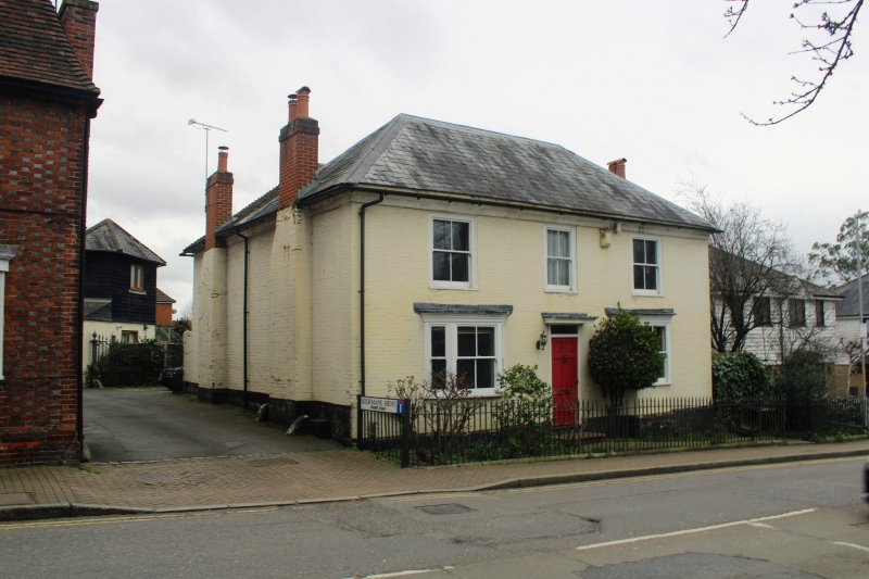
Entry Name: 7, Bow Road
Listing Date: 19 April 1985
Grade: II
Source: Historic England
Source ID: 1070687
English Heritage Legacy ID: 178892
ID on this website: 101070687
Location: Wateringbury, Tonbridge and Malling, Kent, ME18
County: Kent
District: Tonbridge and Malling
Civil Parish: Wateringbury
Built-Up Area: Wateringbury
Traditional County: Kent
Lieutenancy Area (Ceremonial County): Kent
Church of England Parish: Wateringbury St John the Baptist
Church of England Diocese: Rochester
Tagged with: Building
TQ 65 SE WATERINGBURY BOW ROAD
(east side)
2/130 No 7
GV II
House. Early C19. Painted brick with hipped slate roof. 2 storeys, 3 windows.
Ground floor with 2 canted bay windows and central door replaced by window.
Glazing-bar sash windows. Entrance now at rear. Included for group value.
Listing NGR: TQ6917053448
External links are from the relevant listing authority and, where applicable, Wikidata. Wikidata IDs may be related buildings as well as this specific building. If you want to add or update a link, you will need to do so by editing the Wikidata entry.


Other nearby listed buildings
