Approximate Location Map
Large Map »
Latitude: 51.2576 / 51°15'27"N
Longitude: 0.4117 / 0°24'42"E
OS Eastings: 568379
OS Northings: 153697
OS Grid: TQ683536
Mapcode National: GBR NPY.2WY
Mapcode Global: VHJMC.3N09
Plus Code: 9F327C56+2M
Entry Name: West Wall and Gates to Wateringbury Place
Listing Date: 19 April 1985
Grade: II
Source: Historic England
Source ID: 1363032
English Heritage Legacy ID: 178907
ID on this website: 101363032
Location: Wateringbury, Tonbridge and Malling, Kent, ME18
County: Kent
District: Tonbridge and Malling
Civil Parish: Wateringbury
Built-Up Area: Wateringbury
Traditional County: Kent
Lieutenancy Area (Ceremonial County): Kent
Church of England Parish: Wateringbury St John the Baptist
Church of England Diocese: Rochester
Tagged with: Wall
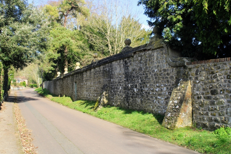
TQ 65 SE WATERINGBURY CANON LANE
(east side)
2/86 West wall and gates to
Wateringbury Place
-
- II
West wall and gates. C18. Tall coursed rubble stone wall with pock-marked
coping. 3 gate-piers with cornice and low pyramid above. Wrought-iron gates
not original, probably late Cl9.
Listing NGR: TQ6837953696
External links are from the relevant listing authority and, where applicable, Wikidata. Wikidata IDs may be related buildings as well as this specific building. If you want to add or update a link, you will need to do so by editing the Wikidata entry.


Other nearby listed buildings
