Approximate Location Map
Large Map »
Latitude: 51.2551 / 51°15'18"N
Longitude: 0.3492 / 0°20'57"E
OS Eastings: 564029
OS Northings: 153276
OS Grid: TQ640532
Mapcode National: GBR NPV.C3L
Mapcode Global: VHJMB.0QG7
Plus Code: 9F32784X+2M
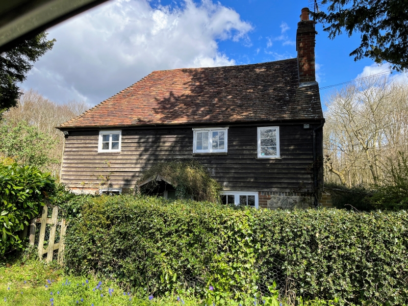
Entry Name: Hurst Cottage
Listing Date: 19 April 1985
Grade: II
Source: Historic England
Source ID: 1107177
English Heritage Legacy ID: 178977
ID on this website: 101107177
Location: Swanton, Tonbridge and Malling, Kent, ME18
County: Kent
District: Tonbridge and Malling
Civil Parish: West Peckham
Traditional County: Kent
Lieutenancy Area (Ceremonial County): Kent
Church of England Parish: West Peckham St Dunstan
Church of England Diocese: Rochester
Tagged with: Cottage
TQ 65 SW WEST PECKHAM STAN LANE (north side)
1/16
- Hurst Cottage
- II
C18 cottage. Randon rubble with red brick dressings on ground floor, creasoted
weather boarding above. Plain tiled roof with ratslide to rear. 2 storeys,
2 windows, C19 easements. Central boarded door.
Listing NGR: TQ6402953276
External links are from the relevant listing authority and, where applicable, Wikidata. Wikidata IDs may be related buildings as well as this specific building. If you want to add or update a link, you will need to do so by editing the Wikidata entry.


Other nearby listed buildings
