Approximate Location Map
Large Map »
Latitude: 51.305 / 51°18'18"N
Longitude: 0.3716 / 0°22'17"E
OS Eastings: 565411
OS Northings: 158880
OS Grid: TQ654588
Mapcode National: GBR NP9.4RQ
Mapcode Global: VHJM4.DG9F
Plus Code: 9F32894C+2J
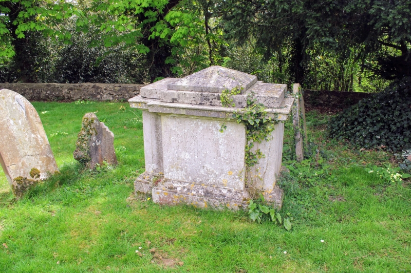
Entry Name: Chest Tomb 20 Yards to East of Addington Church
Listing Date: 25 February 1987
Grade: II
Source: Historic England
Source ID: 1123708
English Heritage Legacy ID: 179194
ID on this website: 101123708
Location: St Margaret's Church, Addington, Tonbridge and Malling, Kent, ME19
County: Kent
District: Tonbridge and Malling
Civil Parish: Addington
Built-Up Area: Addington
Traditional County: Kent
Lieutenancy Area (Ceremonial County): Kent
Church of England Parish: Addington St Margaret
Church of England Diocese: Rochester
Tagged with: Chest tomb
ADDINGTON CP PARK ROAD
TQ 65 NE
(south side)
7/13
Chest tomb 20 yards to
east of Addington
- Church
- II
Chest tomb. Early C18. Stone. Baluster corners. Panelled sides inscribed, as
also coping. Inscription illegible.
Listing NGR: TQ6530458877
External links are from the relevant listing authority and, where applicable, Wikidata. Wikidata IDs may be related buildings as well as this specific building. If you want to add or update a link, you will need to do so by editing the Wikidata entry.


Other nearby listed buildings
