Approximate Location Map
Large Map »
Latitude: 51.0707 / 51°4'14"N
Longitude: 0.6902 / 0°41'24"E
OS Eastings: 588573
OS Northings: 133593
OS Grid: TQ885335
Mapcode National: GBR QW3.TJX
Mapcode Global: FRA D6B9.2QV
Plus Code: 9F323MCR+73
Entry Name: 9, Ashford Road
Listing Date: 8 June 1972
Grade: II
Source: Historic England
Source ID: 1070391
English Heritage Legacy ID: 179673
ID on this website: 101070391
Location: Tenterden, Ashford, Kent, TN30
County: Kent
District: Ashford
Civil Parish: Tenterden
Built-Up Area: Tenterden
Traditional County: Kent
Lieutenancy Area (Ceremonial County): Kent
Tagged with: Building
1.
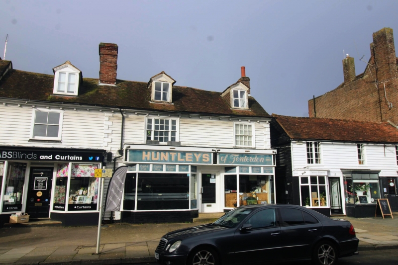
1715 ASHFORD ROAD
(North West Side)
No 9
TQ 8833 1/93
II GV
2.
C18. 2 storeys and attics. Weatherboarded with long and short quoins.
Roof has 2 hipped dormers and modillion eaves cornice. 2 sashes with
glazing bars intact. Doorcase with pilasters, projecting cornice and
6 panelled door, the top 2 panels glazed.
Nos 1 to 13 (odd) form a group.
Listing NGR: TQ8857033592
External links are from the relevant listing authority and, where applicable, Wikidata. Wikidata IDs may be related buildings as well as this specific building. If you want to add or update a link, you will need to do so by editing the Wikidata entry.


Other nearby listed buildings
