Approximate Location Map
Large Map »
Latitude: 51.0676 / 51°4'3"N
Longitude: 0.6878 / 0°41'16"E
OS Eastings: 588417
OS Northings: 133239
OS Grid: TQ884332
Mapcode National: GBR QW3.SW2
Mapcode Global: FRA D6B9.FS7
Plus Code: 9F323M9Q+24
Entry Name: 14 and 16, Bell's Lane
Listing Date: 8 June 1972
Grade: II
Source: Historic England
Source ID: 1363208
English Heritage Legacy ID: 179691
ID on this website: 101363208
Location: Tenterden, Ashford, Kent, TN30
County: Kent
District: Ashford
Civil Parish: Tenterden
Built-Up Area: Tenterden
Traditional County: Kent
Lieutenancy Area (Ceremonial County): Kent
Tagged with: Building
1.
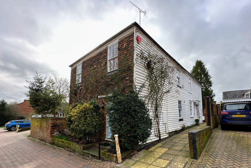
1715 BELL'S LANE
(South West Side)
Nos 14 &16
TQ 8833 1/165
II
2.
Late C18 to early Cl9. 2 storeys weatherboarded. Hipped tiled roof.
3 cambered sashes. Ground floor has shutters. Simple moulded wooden
doorcase with flat weatherhood.
Listing NGR: TQ8841733239
External links are from the relevant listing authority and, where applicable, Wikidata. Wikidata IDs may be related buildings as well as this specific building. If you want to add or update a link, you will need to do so by editing the Wikidata entry.


Other nearby listed buildings
