Approximate Location Map
Large Map »
Latitude: 51.0687 / 51°4'7"N
Longitude: 0.6889 / 0°41'20"E
OS Eastings: 588487
OS Northings: 133373
OS Grid: TQ884333
Mapcode National: GBR QW3.T60
Mapcode Global: FRA D6B9.878
Plus Code: 9F323M9Q+FH
Entry Name: 7, High Street
Listing Date: 8 May 1950
Grade: II
Source: Historic England
Source ID: 1070368
English Heritage Legacy ID: 179713
ID on this website: 101070368
Location: Tenterden, Ashford, Kent, TN30
County: Kent
District: Ashford
Civil Parish: Tenterden
Built-Up Area: Tenterden
Traditional County: Kent
Lieutenancy Area (Ceremonial County): Kent
Tagged with: Building
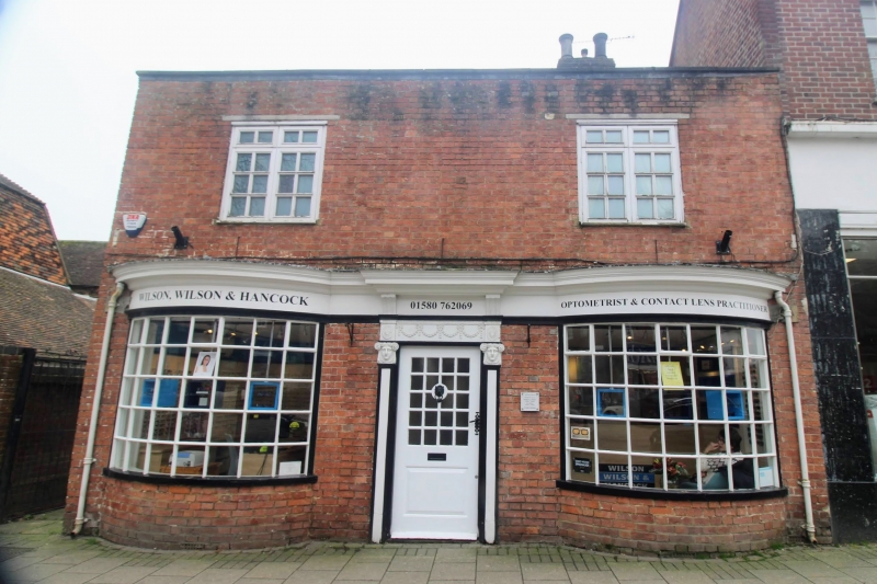
1.
1715 HIGH STREET
(South Side)
No 7
TQ 8833 1/3 8.5.50.
II GV
2.
Early C19. 2 storeys painted brick. Tiled roof. Parapet. 2 sashes
with glazing bars intact. 2 curved shop windows with glazing bars intact.
Doorcase with pilasters having capitals in the form of women's faces with
hair arranged like Ionic volutes and moulded frieze of swags with paterae
at each end. The east side is weatherboarded and has an ornamental bargeboard
to its gable.
Nos 3 to 7 (odd) form a group.
Listing NGR: TQ8848933371
External links are from the relevant listing authority and, where applicable, Wikidata. Wikidata IDs may be related buildings as well as this specific building. If you want to add or update a link, you will need to do so by editing the Wikidata entry.


Other nearby listed buildings
