Approximate Location Map
Large Map »
Latitude: 51.0676 / 51°4'3"N
Longitude: 0.6863 / 0°41'10"E
OS Eastings: 588310
OS Northings: 133244
OS Grid: TQ883332
Mapcode National: GBR QW3.SG4
Mapcode Global: FRA D6B9.F6N
Plus Code: 9F323M9P+3G
Entry Name: 63 and 65, High Street
Listing Date: 8 May 1950
Grade: II
Source: Historic England
Source ID: 1355026
English Heritage Legacy ID: 179728
ID on this website: 101355026
Location: Tenterden, Ashford, Kent, TN30
County: Kent
District: Ashford
Civil Parish: Tenterden
Built-Up Area: Tenterden
Traditional County: Kent
Lieutenancy Area (Ceremonial County): Kent
Tagged with: Building
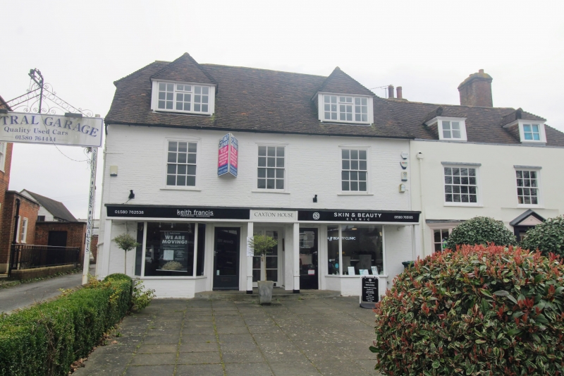
1.
1715 HIGH STREET
(South Side)
Nos 63 & 65
TQ 8833 1/16 8.5.50.
II GV
2.
C18. Probably one house originally. 2 storeys painted brick. Half-hipped
tiled roof. 3 sashes with glazing bars intact. 1st floor windows have
cambered head linings. 2 small bay windows on ground floor. No 63 has
a doorcase with flat hood over and a 6 panel moulded door, the top 2 panels
cut away and glazed. Another similar door inserted in No 65.
Nos 63 to 67 (odd) form a group.
Listing NGR: TQ8831233238
External links are from the relevant listing authority and, where applicable, Wikidata. Wikidata IDs may be related buildings as well as this specific building. If you want to add or update a link, you will need to do so by editing the Wikidata entry.


Other nearby listed buildings
