Approximate Location Map
Large Map »
Latitude: 51.0676 / 51°4'3"N
Longitude: 0.6862 / 0°41'10"E
OS Eastings: 588303
OS Northings: 133239
OS Grid: TQ883332
Mapcode National: GBR QW3.SDV
Mapcode Global: FRA D6B9.F4G
Plus Code: 9F323M9P+2F
Entry Name: Beach House
Listing Date: 8 May 1950
Grade: II
Source: Historic England
Source ID: 1363176
English Heritage Legacy ID: 179729
ID on this website: 101363176
Location: Tenterden, Ashford, Kent, TN30
County: Kent
District: Ashford
Civil Parish: Tenterden
Built-Up Area: Tenterden
Traditional County: Kent
Lieutenancy Area (Ceremonial County): Kent
Tagged with: House
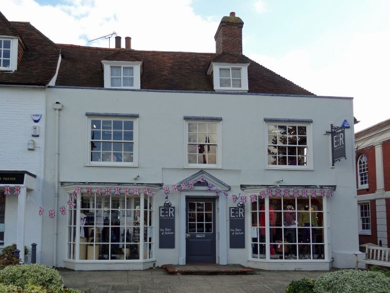
1.
1715 HIGH STREET
(South Side)
No 67 (Beach House)
TQ 8833 1/17 8.5.50.
II GV
2.
An C18 house now refronted in stucco. 2 storeys and attic. Parapet.
2 dormers. 3 windows with glazing bars missing. 2 bay windows on ground
and 1st floors. The original doorcase has gone. The side elevation has
a tile-hung 1st floor.
Nos 63 to 67 (odd) form a group.
Listing NGR: TQ8830633231
External links are from the relevant listing authority and, where applicable, Wikidata. Wikidata IDs may be related buildings as well as this specific building. If you want to add or update a link, you will need to do so by editing the Wikidata entry.


Other nearby listed buildings
