Approximate Location Map
Large Map »
Latitude: 51.0689 / 51°4'7"N
Longitude: 0.6884 / 0°41'18"E
OS Eastings: 588449
OS Northings: 133388
OS Grid: TQ884333
Mapcode National: GBR QW3.T0S
Mapcode Global: FRA D6B9.80M
Plus Code: 9F323M9Q+H8
Entry Name: Elmstone House
Listing Date: 8 April 1970
Grade: II
Source: Historic England
Source ID: 1363199
English Heritage Legacy ID: 179743
ID on this website: 101363199
Location: Tenterden, Ashford, Kent, TN30
County: Kent
District: Ashford
Civil Parish: Tenterden
Built-Up Area: Tenterden
Traditional County: Kent
Lieutenancy Area (Ceremonial County): Kent
Tagged with: House
1.
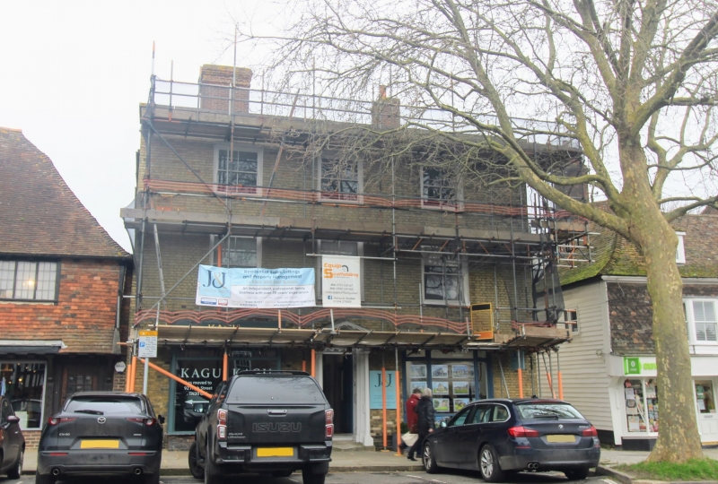
1715 HIGH STREET
(North Side)
No 16 ("Elmstone House")
TQ 8833 1/31 8.4.70.
II GV
2.
Early Cl9 facade. 3 storeys faced with buff mathematical tiles. Parapet.
3 sashes with glazing bars missing. The ground floor has 1 bay window
and a modern shopfront. Doorcase between with thin columns, open pediment,
semi-circular fanlight and 6 panel moulded door.
All the listed buildings on the north side from Nos 10 to 44, including
Church of St Mildred, form a group.
Listing NGR: TQ8845033392
External links are from the relevant listing authority and, where applicable, Wikidata. Wikidata IDs may be related buildings as well as this specific building. If you want to add or update a link, you will need to do so by editing the Wikidata entry.


Other nearby listed buildings
