Approximate Location Map
Large Map »
Latitude: 51.0681 / 51°4'5"N
Longitude: 0.6861 / 0°41'9"E
OS Eastings: 588293
OS Northings: 133293
OS Grid: TQ882332
Mapcode National: GBR QW3.SCD
Mapcode Global: FRA D6B9.748
Plus Code: 9F323M9P+6C
Entry Name: 64 and 66, High Street
Listing Date: 8 April 1970
Grade: II
Source: Historic England
Source ID: 1070348
English Heritage Legacy ID: 179759
ID on this website: 101070348
Location: Tenterden, Ashford, Kent, TN30
County: Kent
District: Ashford
Civil Parish: Tenterden
Built-Up Area: Tenterden
Traditional County: Kent
Lieutenancy Area (Ceremonial County): Kent
Tagged with: Building
1.
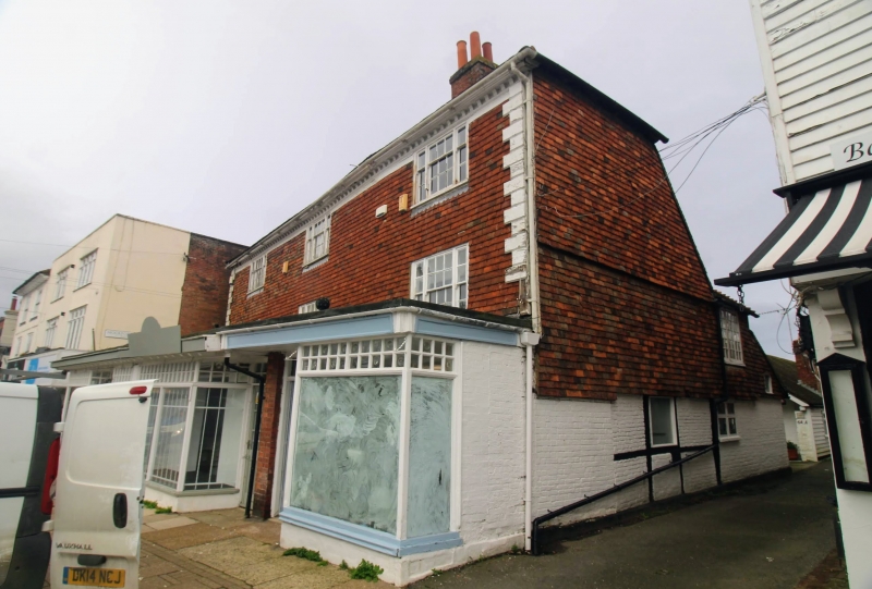
1715 HIGH STREET
(North Side)
Nos 64 & 66
TQ 8833 1/46 8.4.70
II GV
2.
C18. 3 storeys timber-framed and tile-hung. Hipped roof having wooden eaves
cornice, with, modillions. Long and short wooden quoins. 3 sashes with glazing
bars intact. Modern shopfronts built out in front.
No 60 to 66 (even) form a group.
Listing NGR: TQ8829433297
External links are from the relevant listing authority and, where applicable, Wikidata. Wikidata IDs may be related buildings as well as this specific building. If you want to add or update a link, you will need to do so by editing the Wikidata entry.


Other nearby listed buildings
