Approximate Location Map
Large Map »
Latitude: 51.0677 / 51°4'3"N
Longitude: 0.6849 / 0°41'5"E
OS Eastings: 588212
OS Northings: 133252
OS Grid: TQ882332
Mapcode National: GBR QW3.S16
Mapcode Global: FRA D6B9.DMR
Plus Code: 9F323M9M+3X
Entry Name: 90 and 92, High Street
Listing Date: 8 June 1972
Grade: II
Source: Historic England
Source ID: 1070350
English Heritage Legacy ID: 179764
ID on this website: 101070350
Location: Tenterden, Ashford, Kent, TN30
County: Kent
District: Ashford
Civil Parish: Tenterden
Built-Up Area: Tenterden
Traditional County: Kent
Lieutenancy Area (Ceremonial County): Kent
Tagged with: Building
1.
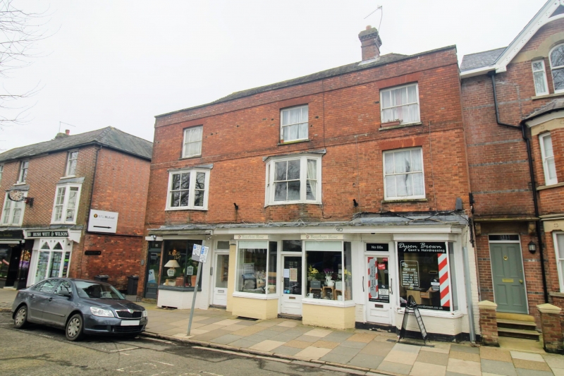
1715 HIGH STREET
(North Side)
Nos 90 & 92
TQ 8833 1/49
II GV
2.
Originally one house, now 2 shops. Late C18 to early C19. 3 storeys red
brick. Hipped tile roof. Parapet and stringcourse above 1st floor. 3 sashes
with glazing bars missing. 2 small bay windows on the 1st floor. Modern shop
fronts. High carriage entrance at the east end of the front. The building
was probably an inn originally. Grade II for group value.
Nos 90 to 98 (even) form a group.
Listing NGR: TQ8821433256
External links are from the relevant listing authority and, where applicable, Wikidata. Wikidata IDs may be related buildings as well as this specific building. If you want to add or update a link, you will need to do so by editing the Wikidata entry.


Other nearby listed buildings
