Approximate Location Map
Large Map »
Latitude: 51.0677 / 51°4'3"N
Longitude: 0.6846 / 0°41'4"E
OS Eastings: 588193
OS Northings: 133244
OS Grid: TQ881332
Mapcode National: GBR QW2.ZX9
Mapcode Global: FRA D6B9.DJH
Plus Code: 9F323M9M+3V
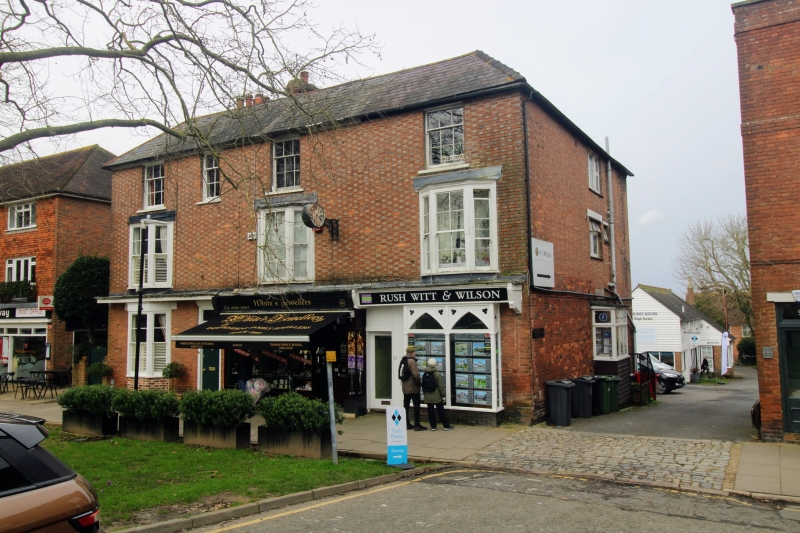
Entry Name: 94-98, High Street
Listing Date: 8 June 1972
Grade: II
Source: Historic England
Source ID: 1070351
English Heritage Legacy ID: 179765
ID on this website: 101070351
Location: Tenterden, Ashford, Kent, TN30
County: Kent
District: Ashford
Civil Parish: Tenterden
Built-Up Area: Tenterden
Traditional County: Kent
Lieutenancy Area (Ceremonial County): Kent
Tagged with: Building
1.
1715 HIGH STREET
(North Side)
Nos 94 to 98 (even)
TQ 8833 1/193
II GV
2.
Mid C19. 3 storeys red brick with grey headers. Hipped slate roof. 4 sashes
with glazing bars intact. 1st floor has 3 3 light bays. Shopfronts.
Nos 90 to 98 (even) form a group.
Listing NGR: TQ8820633251
External links are from the relevant listing authority and, where applicable, Wikidata. Wikidata IDs may be related buildings as well as this specific building. If you want to add or update a link, you will need to do so by editing the Wikidata entry.


Other nearby listed buildings
