Approximate Location Map
Large Map »
Latitude: 51.0671 / 51°4'1"N
Longitude: 0.683 / 0°40'58"E
OS Eastings: 588078
OS Northings: 133181
OS Grid: TQ880331
Mapcode National: GBR QW8.5GD
Mapcode Global: FRA D699.KWQ
Plus Code: 9F323M8M+V5
Entry Name: 126 and 126A, High Street
Listing Date: 8 April 1970
Grade: II
Source: Historic England
Source ID: 1070354
English Heritage Legacy ID: 179772
ID on this website: 101070354
Location: Tenterden, Ashford, Kent, TN30
County: Kent
District: Ashford
Civil Parish: Tenterden
Built-Up Area: Tenterden
Traditional County: Kent
Lieutenancy Area (Ceremonial County): Kent
Tagged with: Building
1.
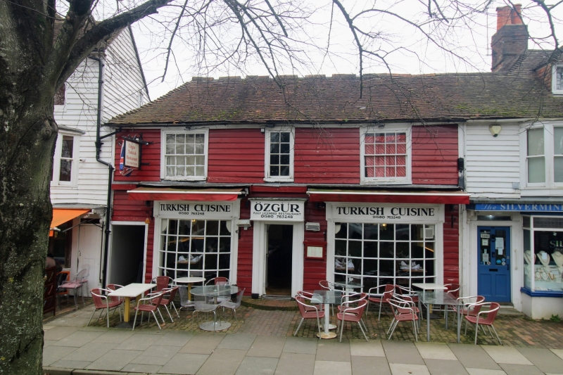
1715 HIGH STREET
(North Side)
Nos 126 & 126A
TQ 8833 1/56 8.4.70.
II GV
2.
C18. 2 storeys timber-framed and weatherboarded. Tiled roof. 3 windows,
2 of which are sashes. Restored. C18 type bow fronts.
All the listed buildings on the north side from Nos 112 to 134 form a group.
Listing NGR: TQ8808333184
External links are from the relevant listing authority and, where applicable, Wikidata. Wikidata IDs may be related buildings as well as this specific building. If you want to add or update a link, you will need to do so by editing the Wikidata entry.


Other nearby listed buildings
