Approximate Location Map
Large Map »
Latitude: 51.0671 / 51°4'1"N
Longitude: 0.6829 / 0°40'58"E
OS Eastings: 588074
OS Northings: 133177
OS Grid: TQ880331
Mapcode National: GBR QW8.5GD
Mapcode Global: FRA D699.KVM
Plus Code: 9F323M8M+R5
Entry Name: 128 and 130, High Street
Listing Date: 8 April 1970
Grade: II
Source: Historic England
Source ID: 1070355
English Heritage Legacy ID: 179773
ID on this website: 101070355
Location: Tenterden, Ashford, Kent, TN30
County: Kent
District: Ashford
Civil Parish: Tenterden
Built-Up Area: Tenterden
Traditional County: Kent
Lieutenancy Area (Ceremonial County): Kent
Tagged with: Building
1.
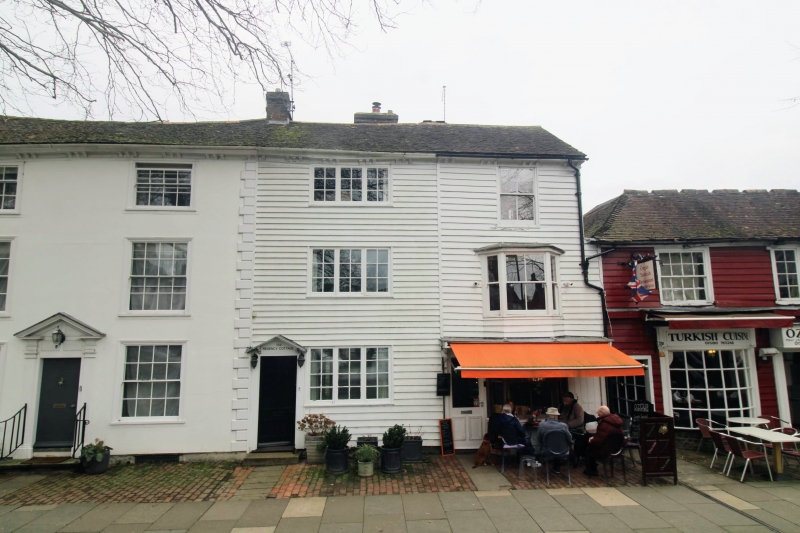
1715 HIGH STREET
(North Side)
Nos 128 & 130
TQ 8833 1/57 8.4.70.
II GV
2.
C18. 3 storeys timber-framed with weatherboarded facade. Bracket eaves
cornice. 2 windows. No 128 has sash windows with glazing bars missing
and a bay window on the ground and 1st floor. No 130 has casement windows
and a pediment shaped hood over the door.
All the listed buildings on the north side from Nos 112 to 134 form a group.
Listing NGR: TQ8807133178
External links are from the relevant listing authority and, where applicable, Wikidata. Wikidata IDs may be related buildings as well as this specific building. If you want to add or update a link, you will need to do so by editing the Wikidata entry.


Other nearby listed buildings
